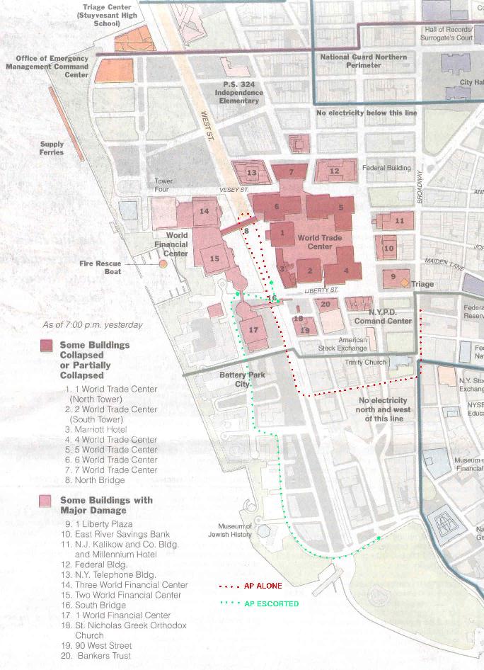
5 October 2001. Add WTC site map and additional annotations on photograph listing. Map from the New York Times, September 13, 2001.
4 October 2001. Thanks to Anonymous Photographer (AP). AP's identity is recorded by the NYC Police Department.
There's a New York Times report today on the difficulty of visiting the WTC unless you are a celebrity, friend of the Mayor or the Governor, or a source of rebuilding funds. Even the press find it nearly impossible to see what these freaks knee-jerk to get attention.
Another Times story today says the American Institute of Architects (AIA) is issuing a warning to its members to be careful about providing building information. The operator of Cryptome is not a member of the AIA.
By AP
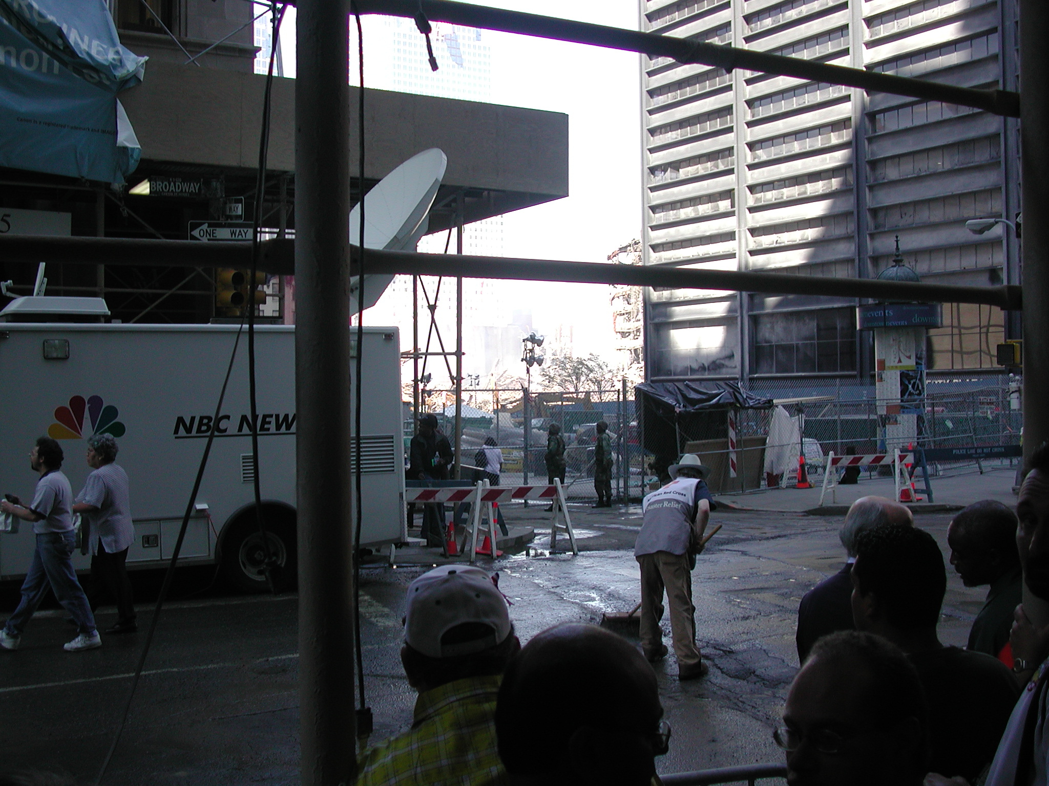
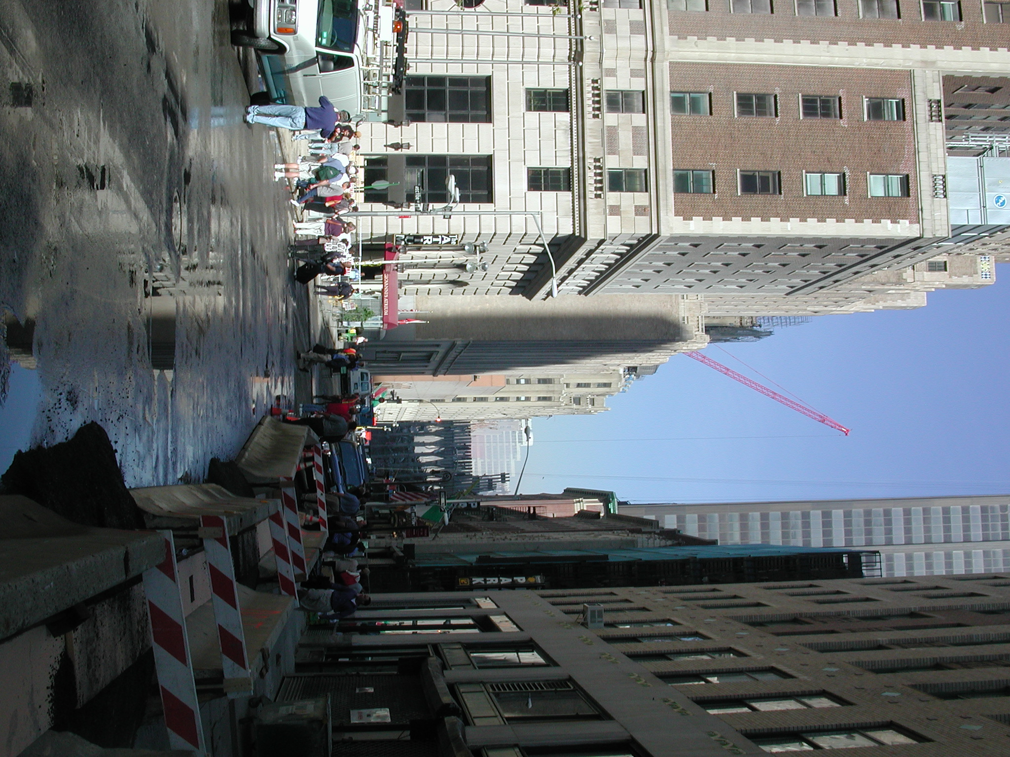
These 72 photographs of the World Trade Center disaster site in New York City were taken by AP on 3 October 2001, about noon. (See map of red path photographed.) The first few, 001-004, were taken from Broadway, walking south, several blocks east of the WTC site from street corners where a part of the site can be seen. These locations are where the public is blocked by barricades and guards.
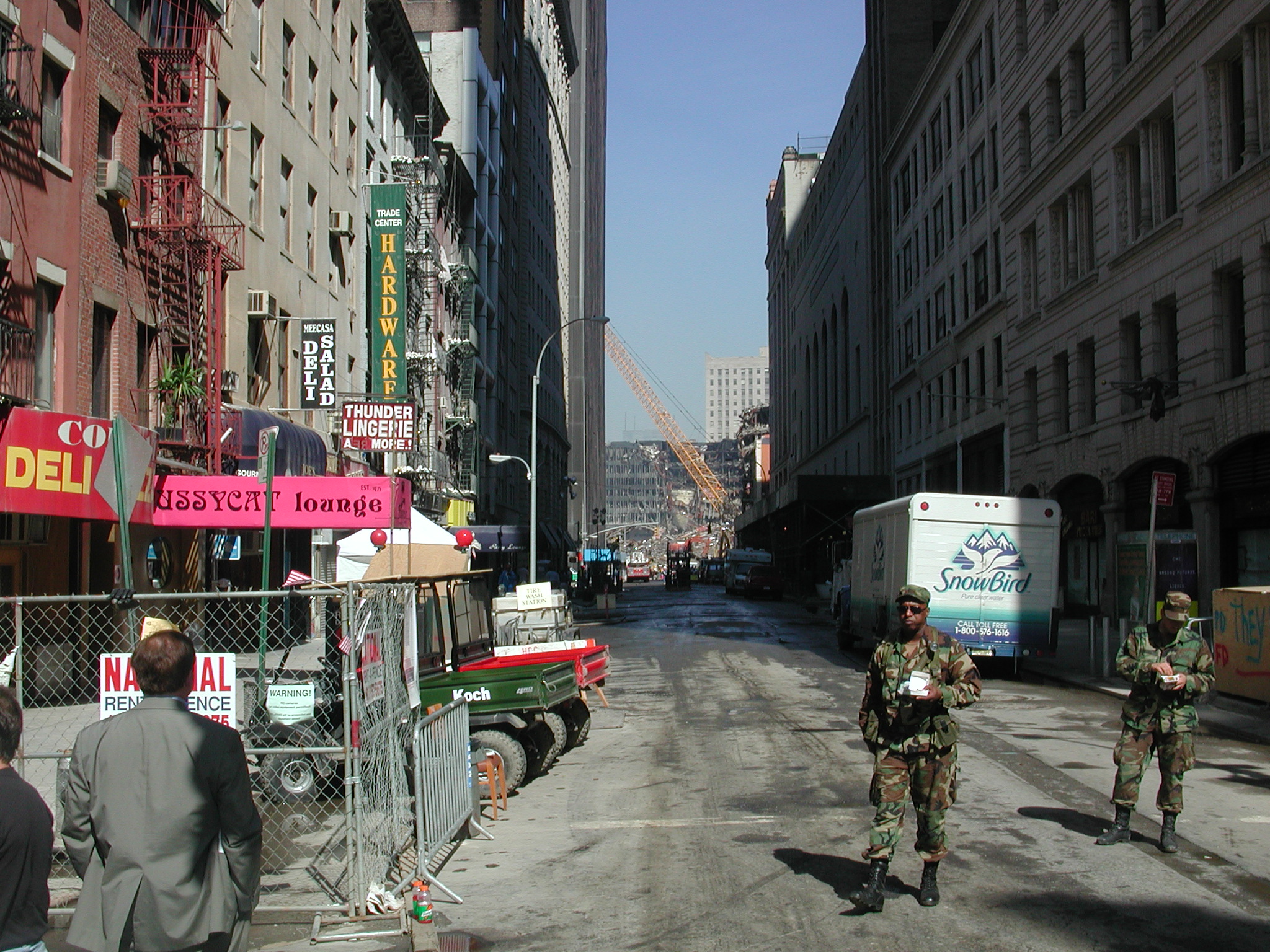
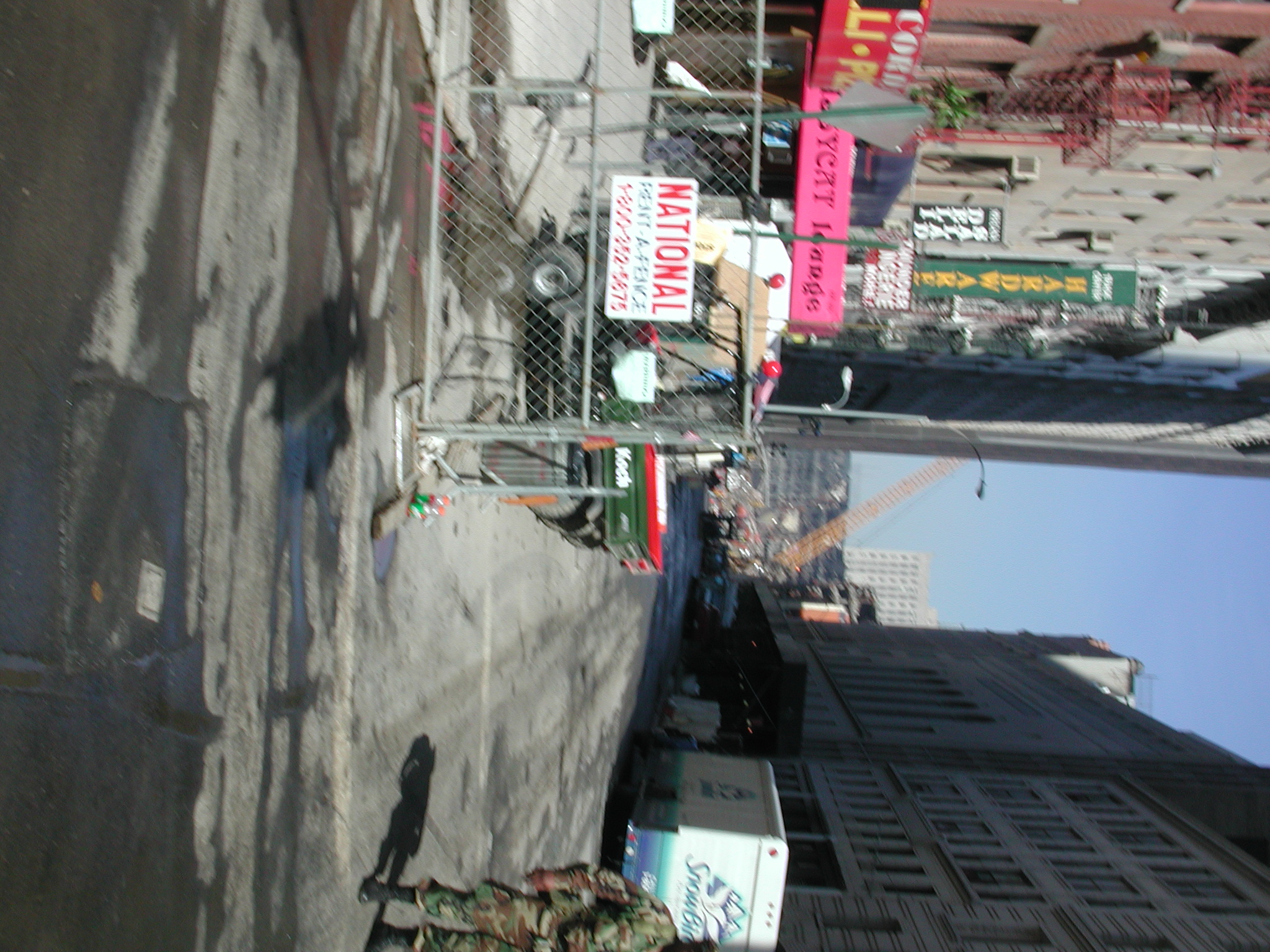
Then a few photos, 005-012, were taken during a walk along Rector Street going west, a couple of blocks south of the site. Every cross street was barricaded and guarded.
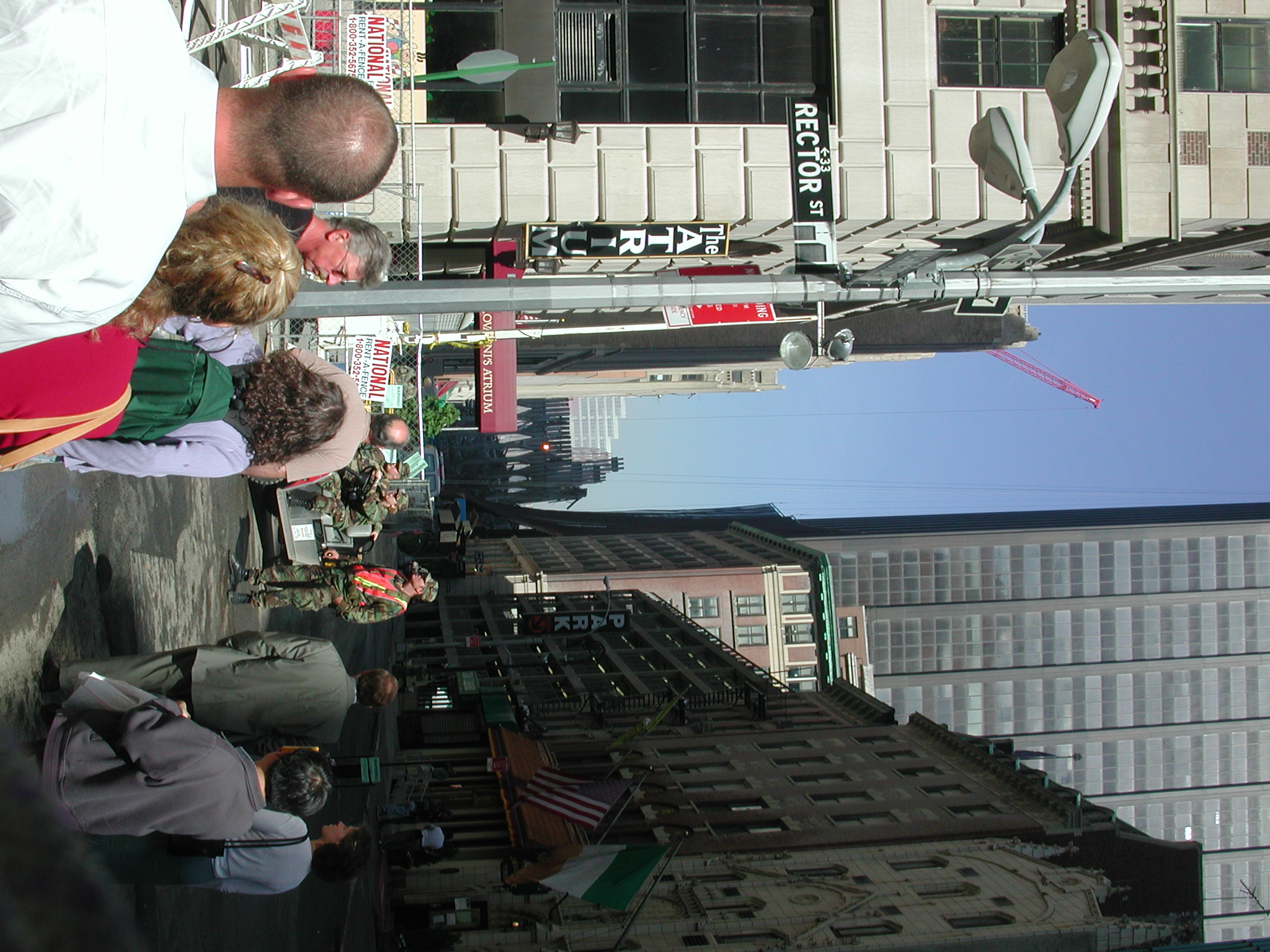
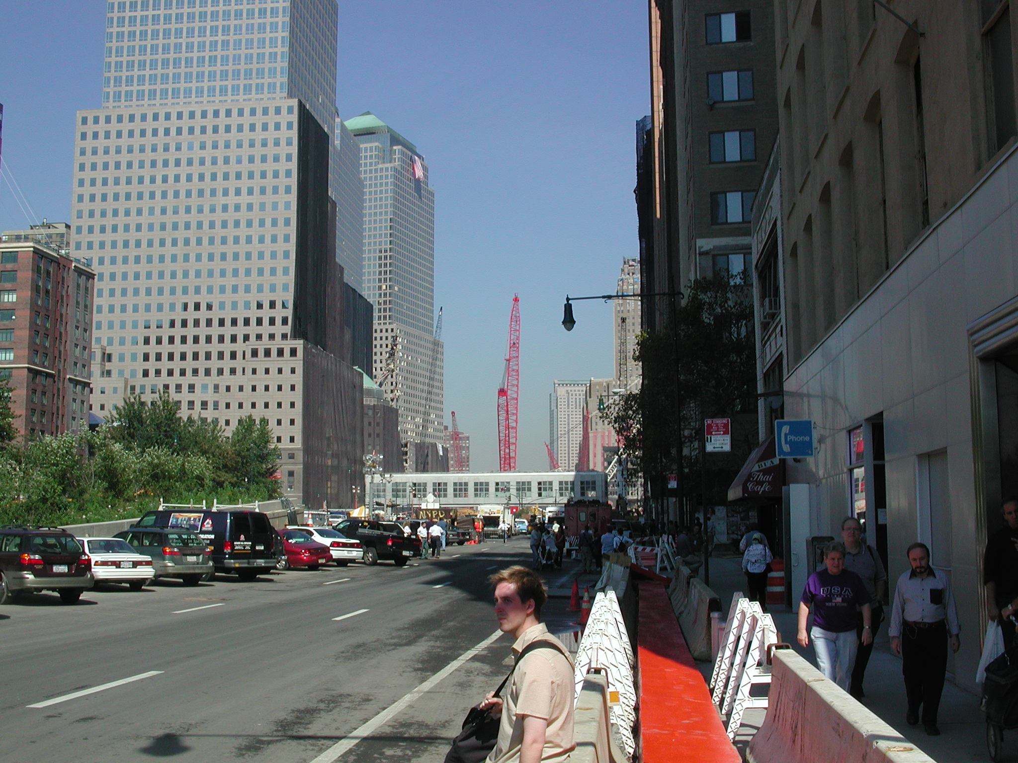
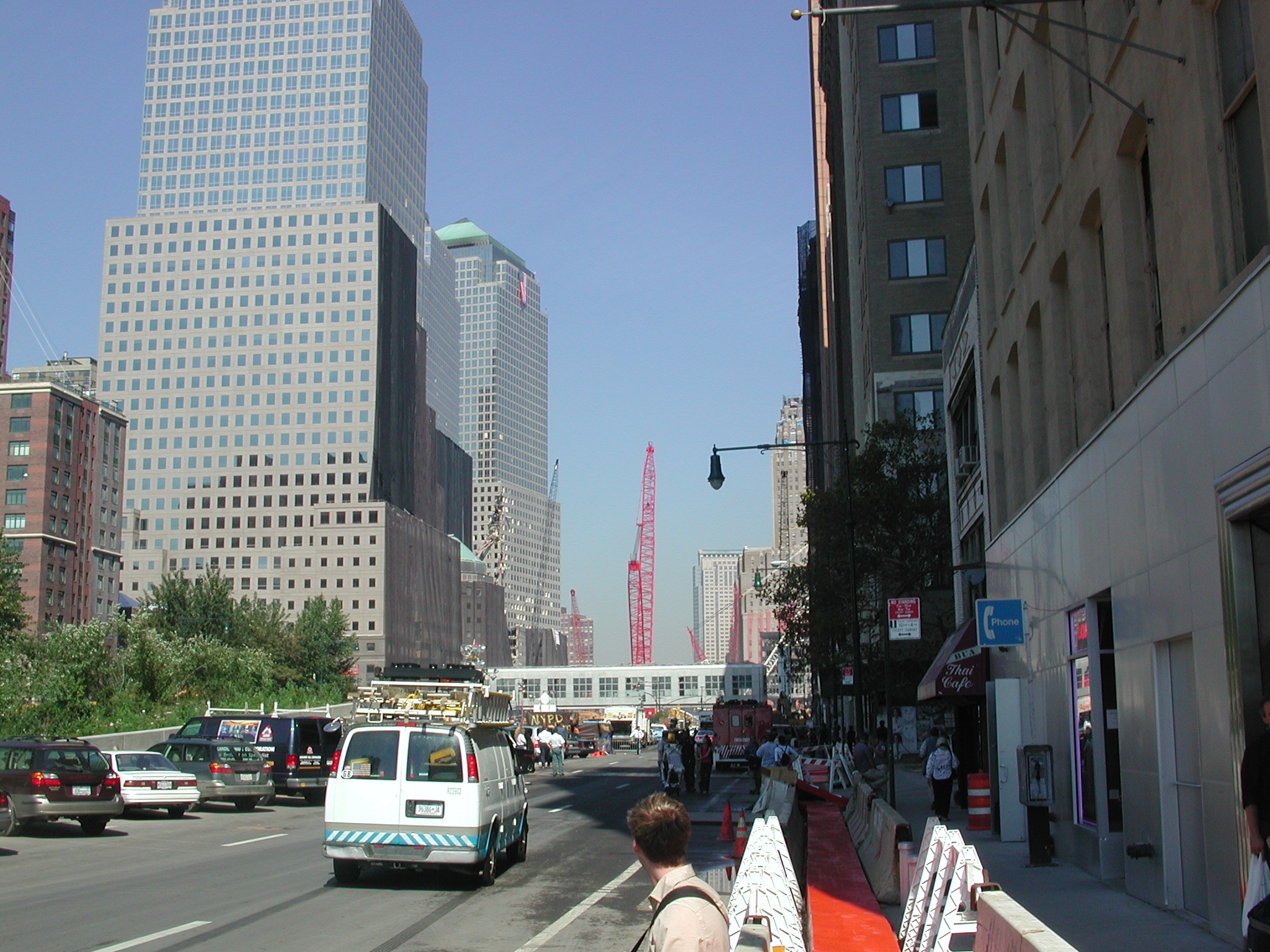
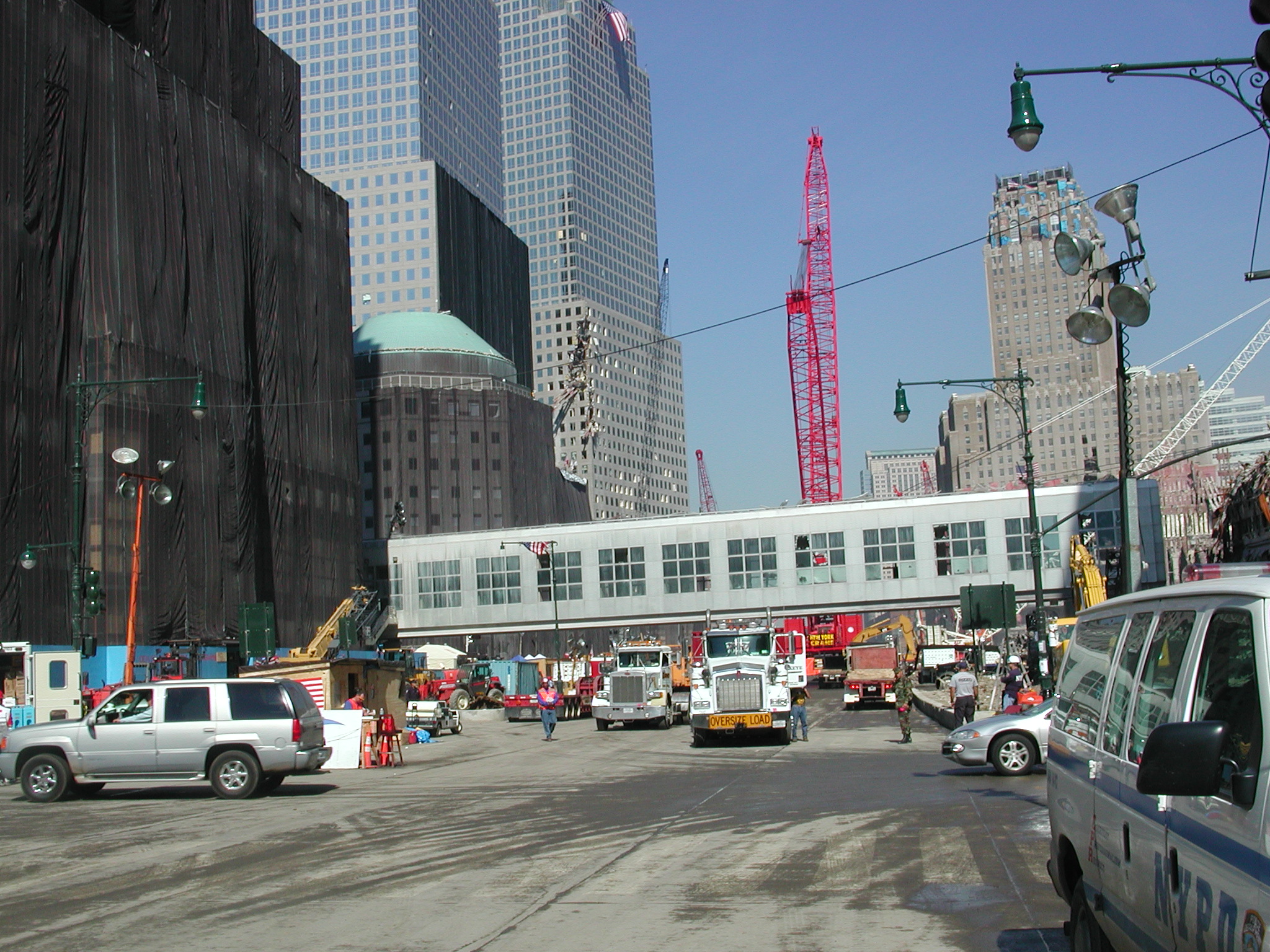
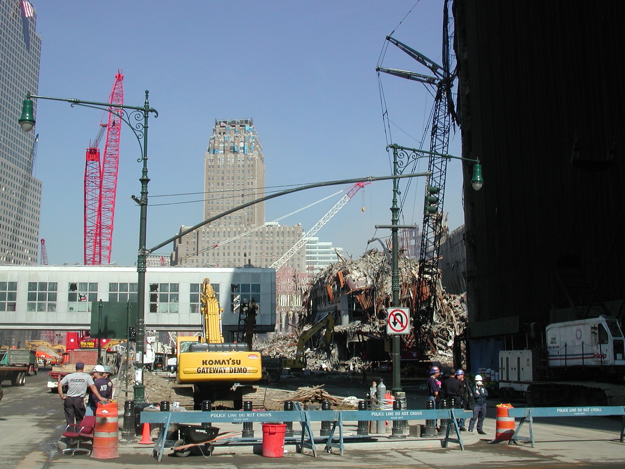
Rector Street intersects the West Street, a wide north-south boulevard which passes by the WTC site. A series of photos, 013-018 were taken walking north toward the site. There were no barricades or guards along this path, which was surprising for most of the site perimeter is carefully guarded by police and the military and the public is kept at least two blocks distant and usually much farther away.
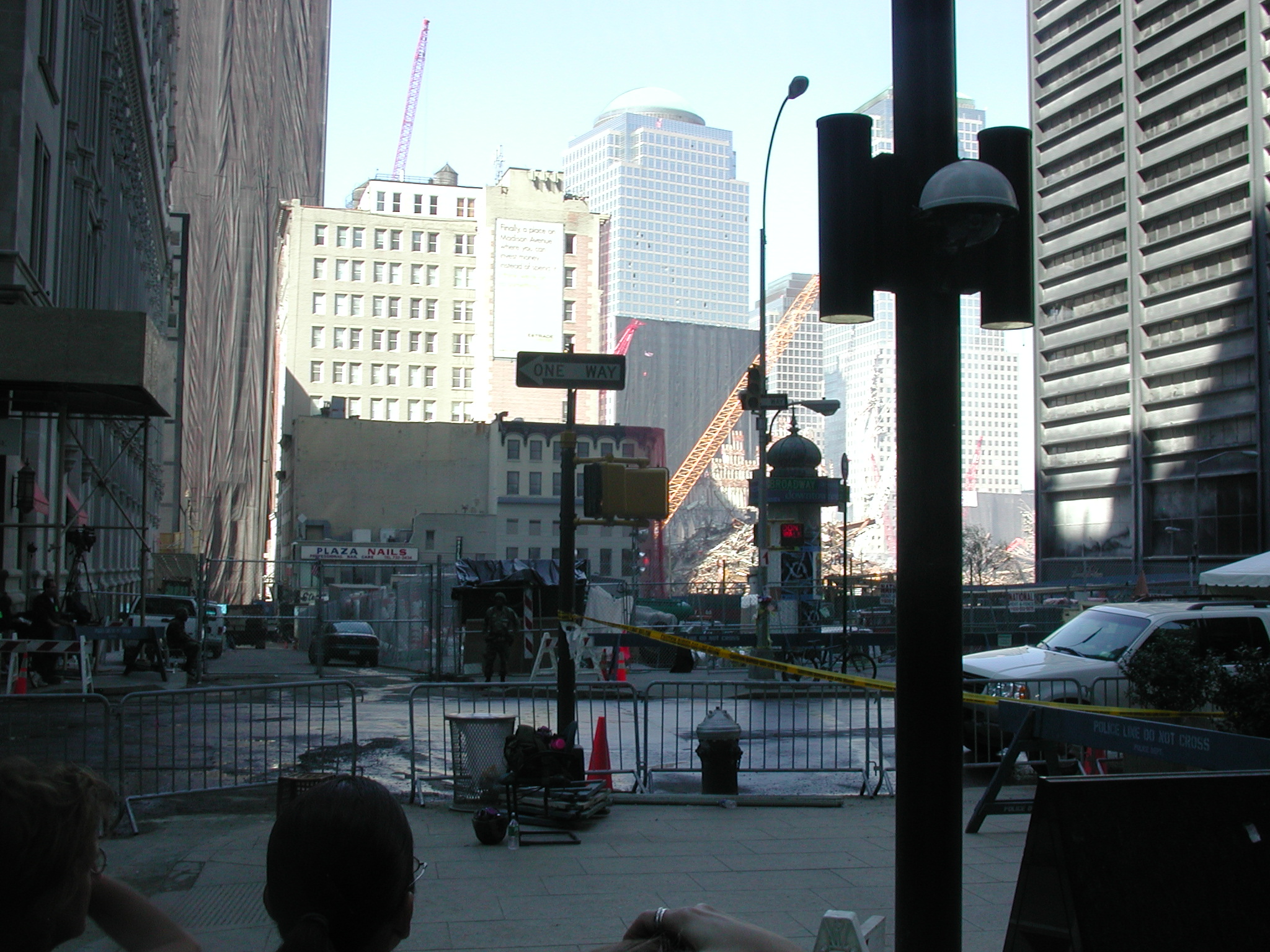
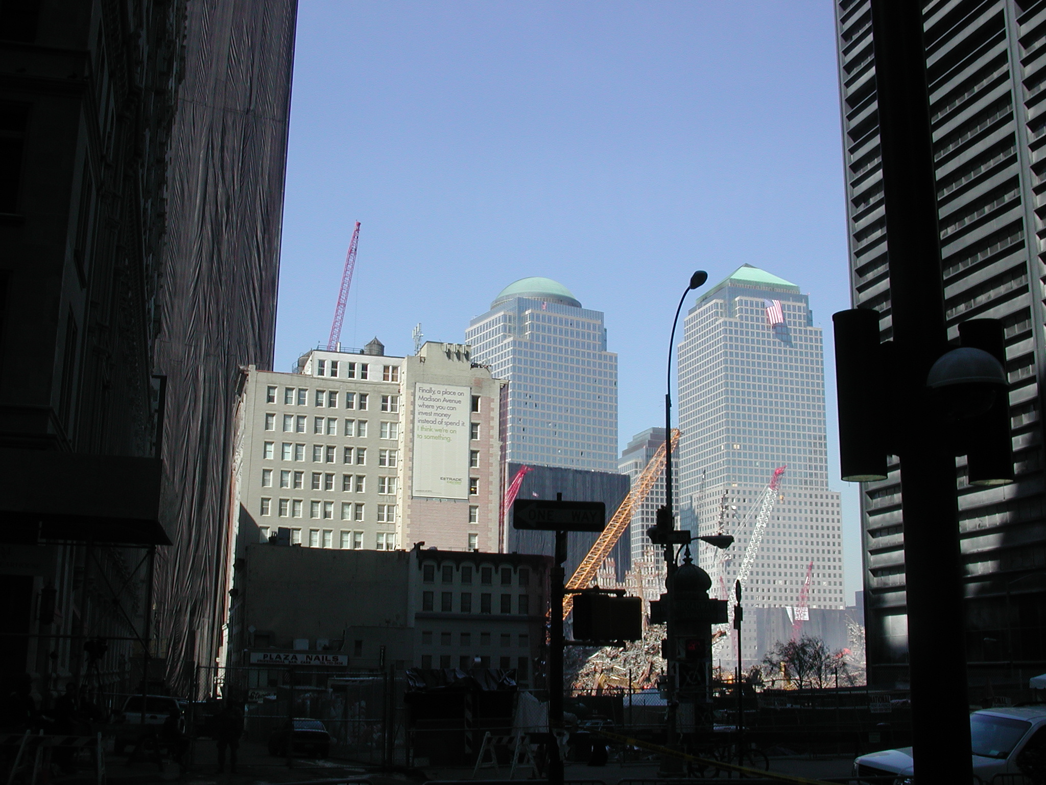
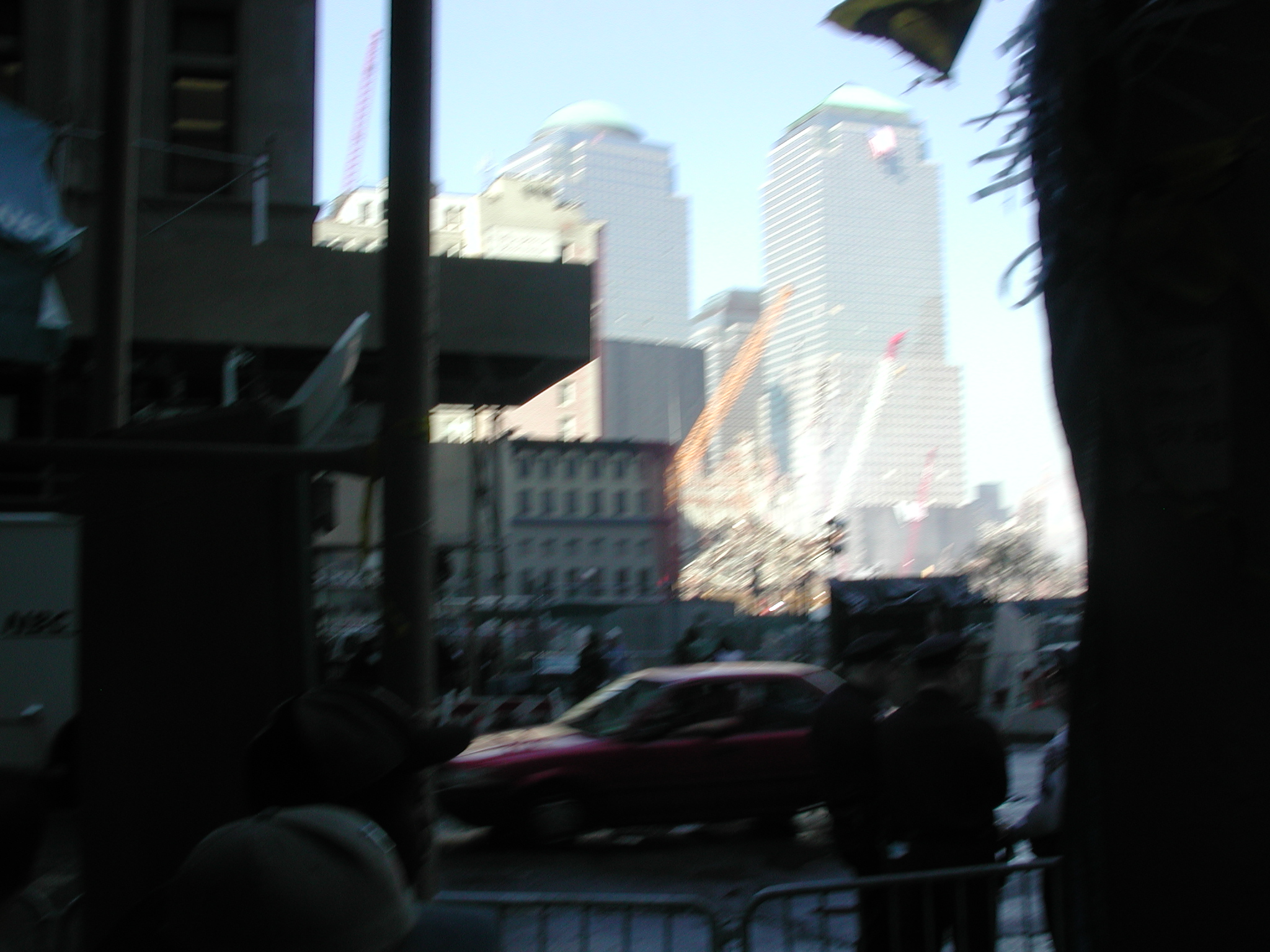
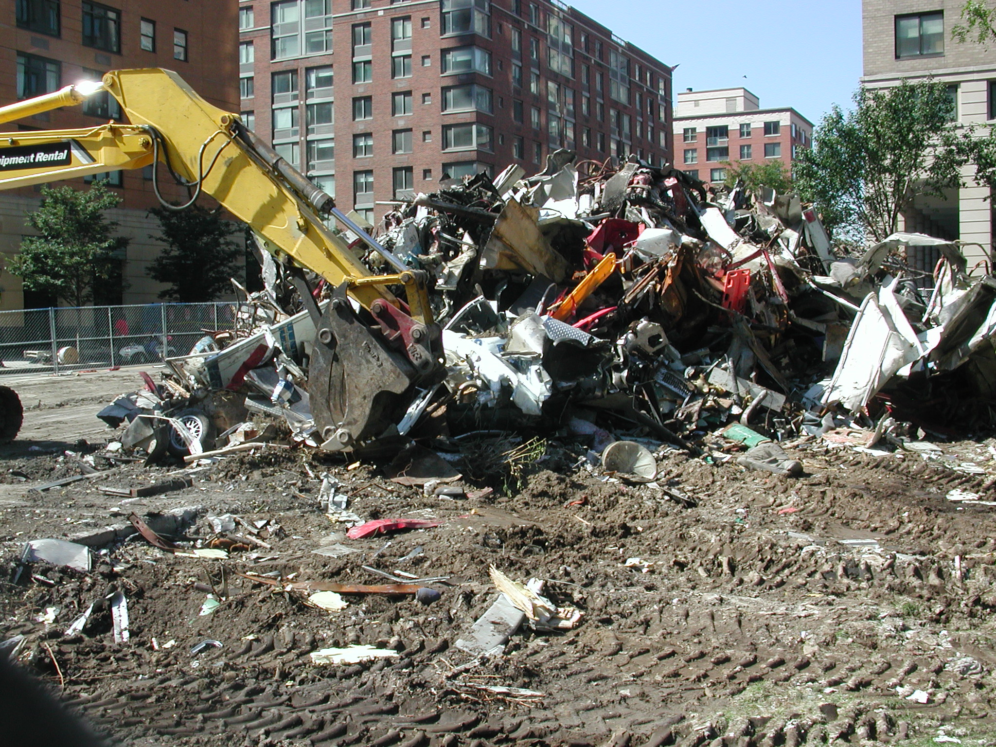
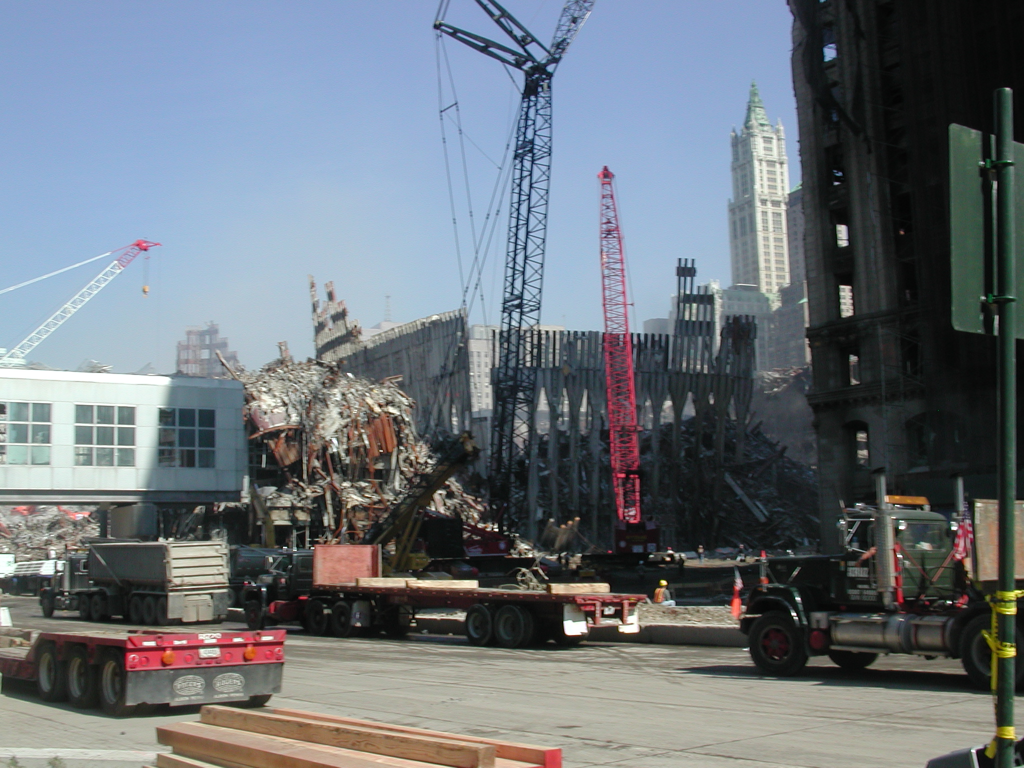
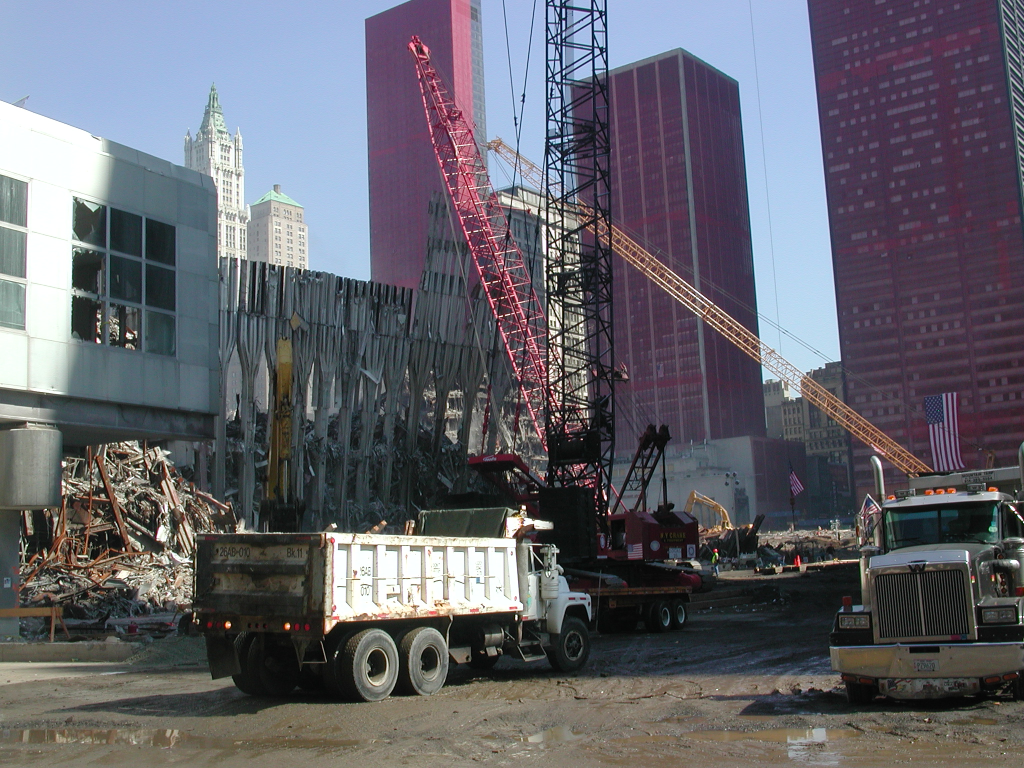
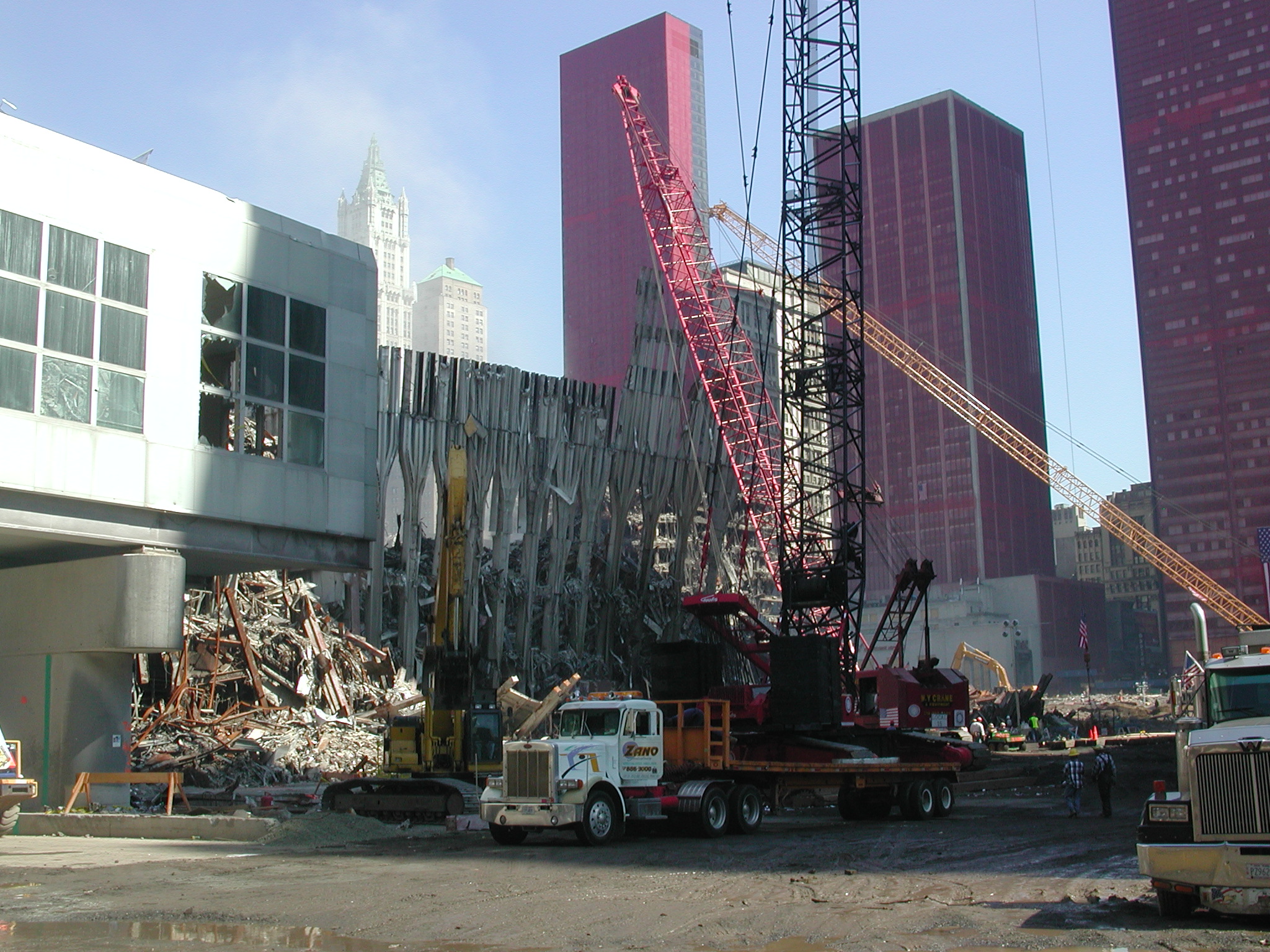
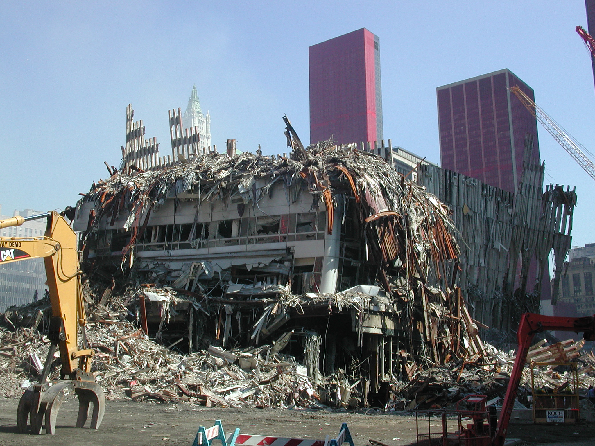
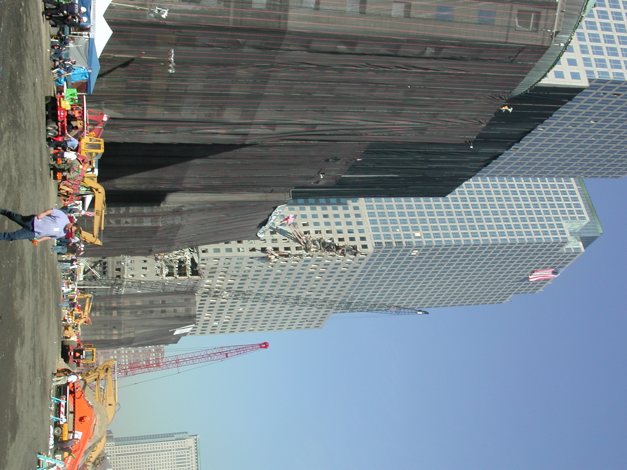
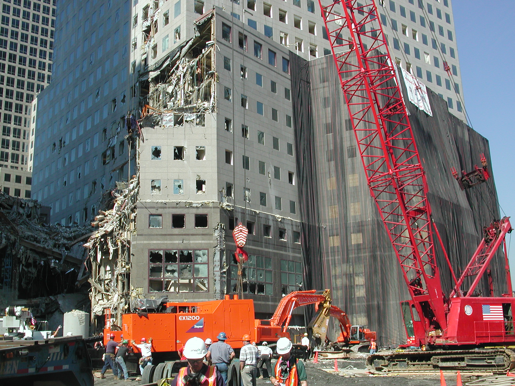
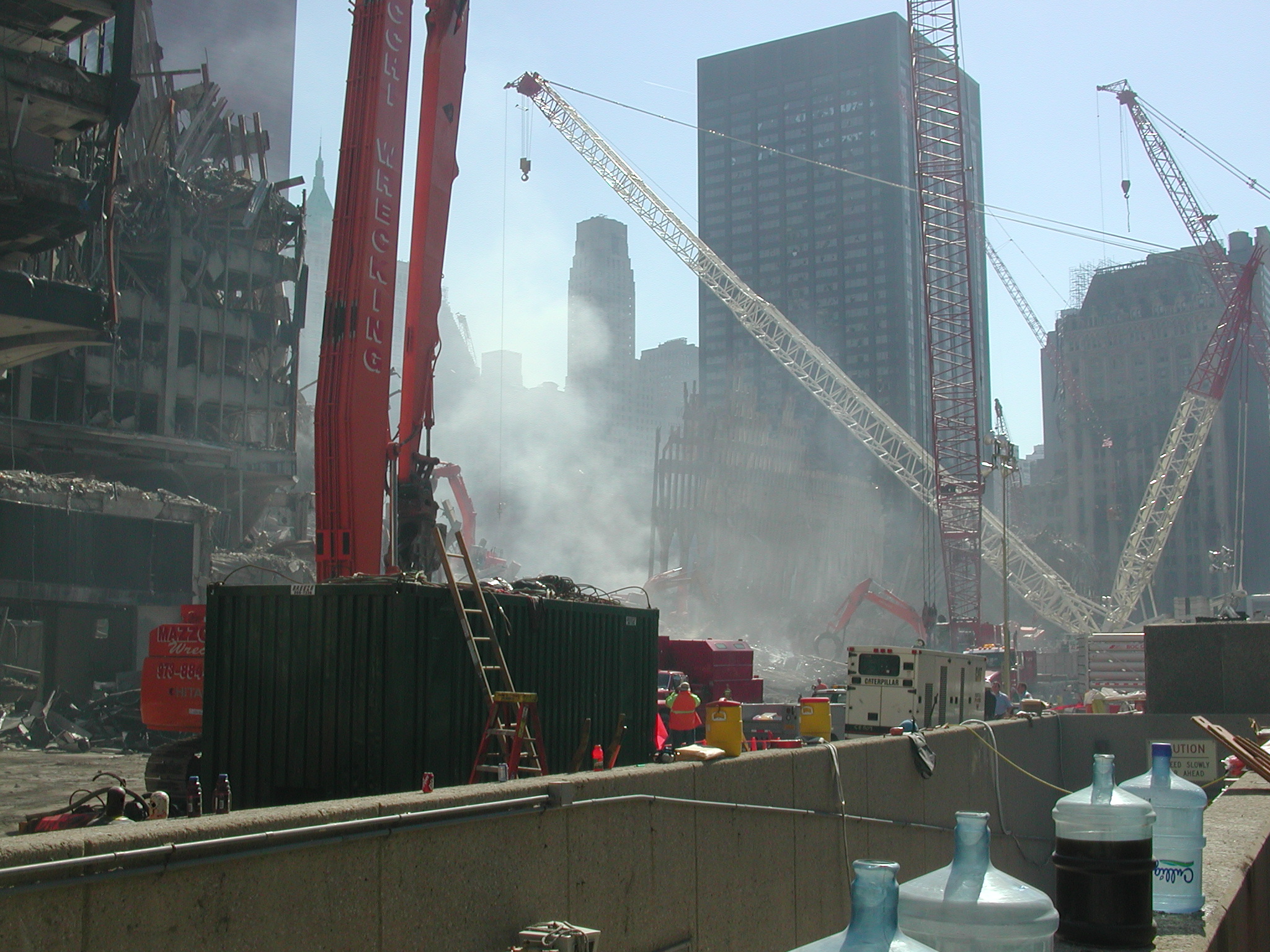
The next photos, 019-051, are close-ups of the site looking east and west from West Street, east to the location of the collapsed World Trade Center and west toward the heavily damaged World Financial Center (WFC) located across the West Side Highway from WTC.
Photos were taken from several angles during a walk north past the sites, and then more, 052-073, taken retracing that path walking south.
At the end of this return walk a NYC police officer asked to be shown authorization for taking photographs (see green path on map). AP said there was none. The officer asked how access to the site was gained. AP said I just walked in. Other police officers were consulted, several said this is a crime scene, no photographs allowed.
A NYC police captain was consulted who directed that AP be escorted from the site but that the digital photos need not be confiscated. The captain advised AP to apply for an official permit to photograph the site.
A NYC police officer took AP to New York State police officers nearby who asked to examine the digital camera and view the photographs. Without telling AP, who was being questioned by a State police officer, the photographs were deleted from the camera's compact flash memory chip by another State police officer.
AP was then escorted to the perimeter of the site by yet another NYC police officer who recorded AP's name, and who issued a warning to stay away from the site or face arrest.
______________________
While waiting to leave the site, a group of victim families were escorted toward the ruins. Many carrying flowers, crying, holding hands, stumbling, dreading their walk into hell -- which the site truely is. A terrible scene of heartbreak far worse than photographs can ever show.
______________________
Later, AP, after discovering the photographs had been deleted, restored them with a program called Photorescue sold by DataRescue, a Belgian company which offers the $20 program online.
The camera used was a Nikon CoolPix 880, with a 192MB Compact Flash memory chip.
For public education. No restrictions on non-commercial reproduction. Credit Cryptome.
Mirror sites of photographs. Please use these mirrors, Cryptome is being hammered by downloads of the large-sized files. Other mirrors welcome, send URLs to: jya@pipeline.com.
http://rearviewmirror.org/wtcphotos/wtc-photos.htm (Washington State)
http://www.parrhesia.com/wtc100301/ (California; offers reduced-sized images)
The entire collection (incl. thumbnails; 15.4MB):
http://www.parrhesia.com/wtc100301/wtc100301.tar
http://www.phonon.net/wtc/ (Massachusetts; offers several reduced sizes of images)
http://weltwissen.koeln.ccc.de/~drt/cryptome.org/wtc/wtc-photos.htm (Germany)
http://166.122.19.198/wtc/wtc-photos.html (Hawaii)
http://www.mit.edu/activities/safe/wtc/wtc-photos.htm (Massachusetts, offers reduced-sizes)
http://www.jal.org/pics/cryptome-wtc/wtc-photos.htm
There is alsohttp://www.jal.org/pics/cryptome-wtc/index.html,
which is a gizmo that will resize images for you on request. It is a bit slow, because it all happens on the fly, but enjoy.
http://www.walled-city.com/cryptome/wtc.htm
http://unbroken.com/wtc/ (Wisconsin)
http://wtc.drno.de (Germany / DFN; with thumbnails)
http://www.minut.ee/images/pildid/wtc/wtc-photos.htm (Estonia)
http://www.user.cityline.ru/~interceptor369/wtc100301/index2.htm (Russia)
Each image is about 1MB, of high resolution JPG. Best viewed on a large monitor.
Path of photographer shown in red on map.
North Tower is also 1 World Trade Center; South Tower is also 2 World Trade Center.
From Broadway looking west, walking south, blocks from WTC site:
wtc001.jpg Looking west, 180 degrees from
photo 049.
wtc002.jpg Looking west, 180 degrees
from photo 049.
wtc003.jpg Out of focus photo.
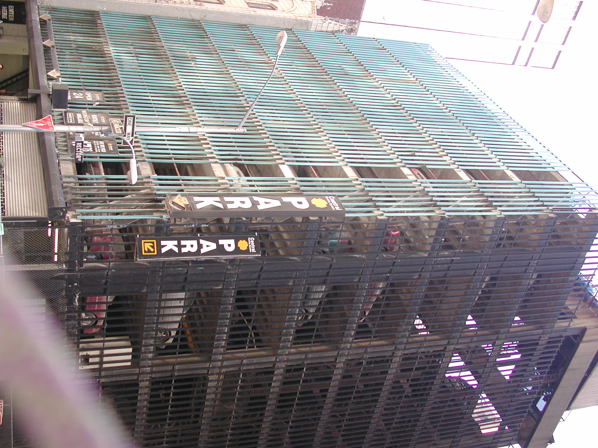
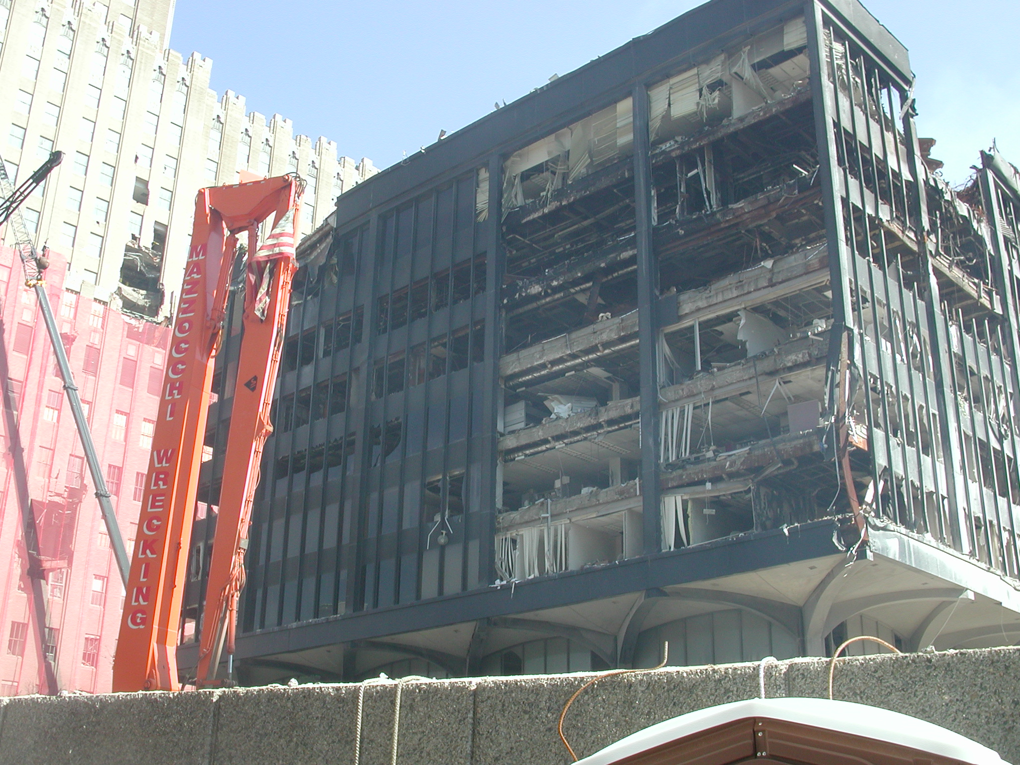
wtc004.jpg Dusty building at right is 1 Liberty
Plaza (map 9), sliver of 4 WTC behind it.
From Rector Street looking north, walking west, still blocks away:
wtc005.jpg Looking north toward remnants
of 5 WTC (map 5).
wtc006.jpg Out of focus photo.
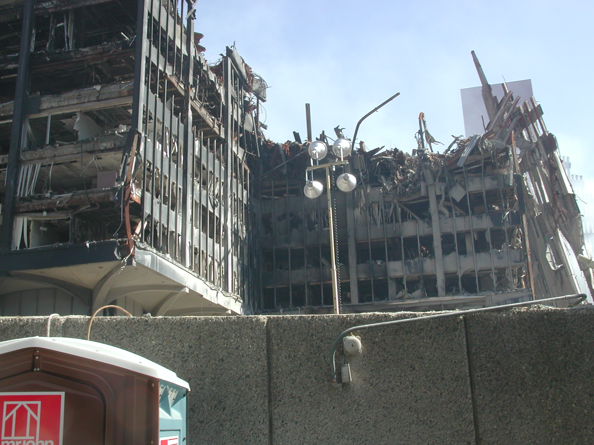
wtc007.jpg Looking north at remnant of South
Tower (map 2).
wtc008.jpg Parking garage with temporarily
(?) abandoned automobiles.
wtc009.jpg Looking north at remnant of South
Tower (map 2).
wtc010.jpg Same.
wtc011.jpg Same.
wtc012.jpg Same.
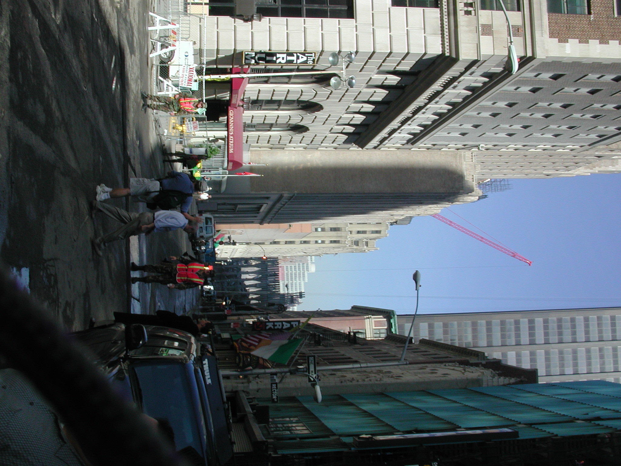
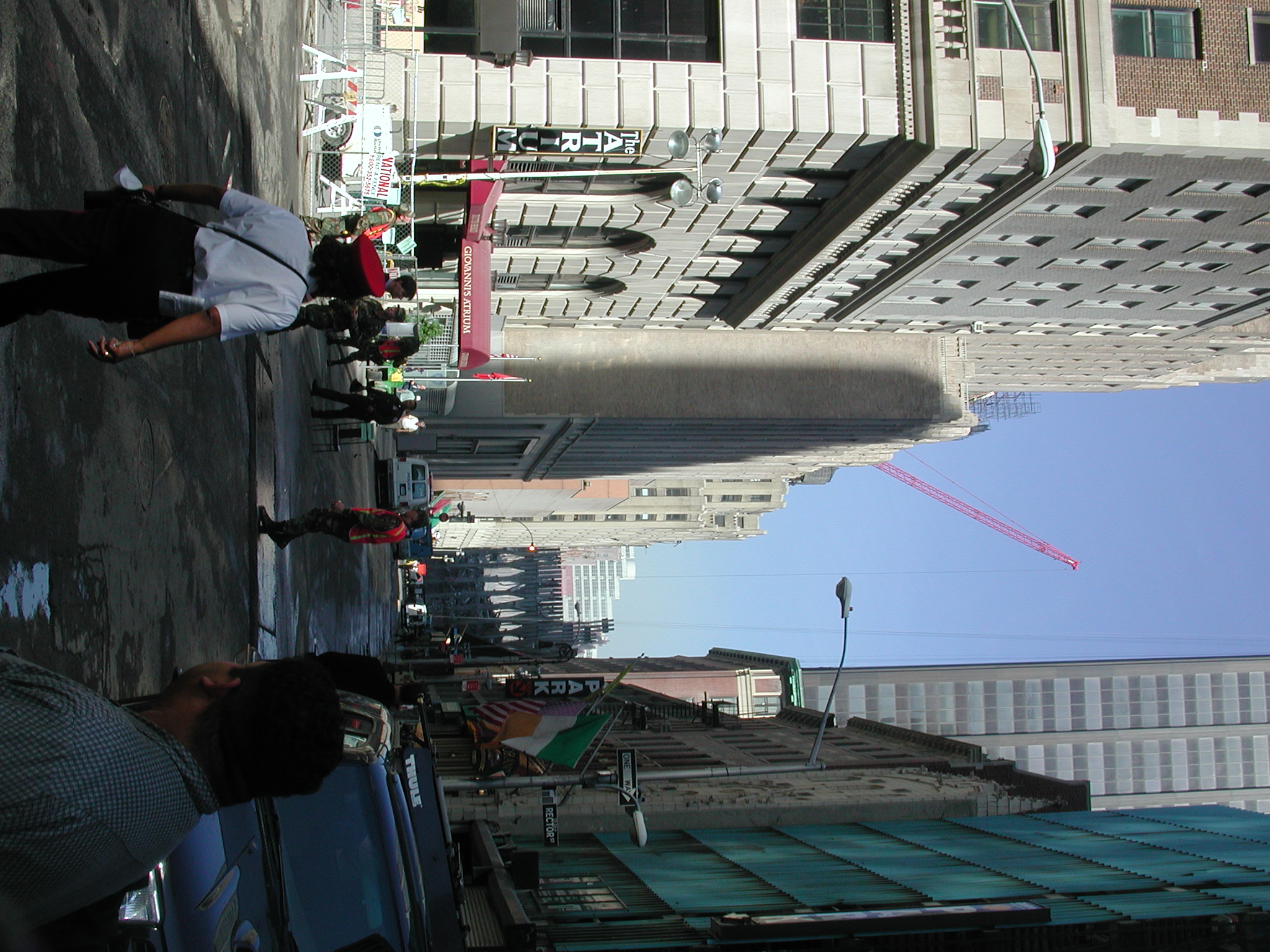
From the West Street looking north, walking toward WTC:
wtc013.jpg Rector Street and West Street,
damaged Amex tower (map 14) in left distance.
wtc014.jpg Same.
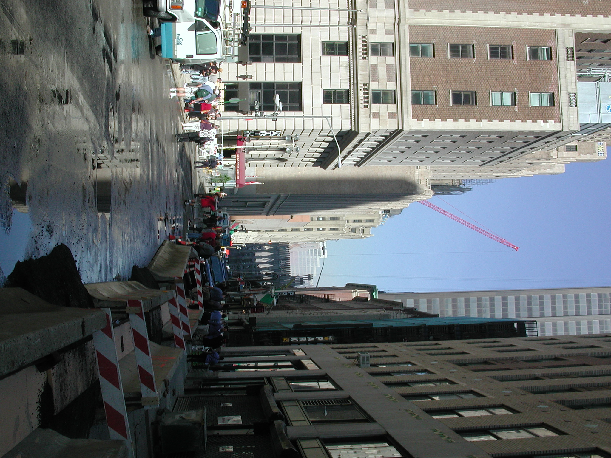
wtc015.jpg Debris removal staging area.
wtc016.jpg Same.
wtc017.jpg South bridge (map 16) connecting
WTC and WFC.
wtc018.jpg South bridge (map 16) and remnants
of Marriott Hotel (map 3).
From the West Street walking north, looking east to the WTC and west to the World Financial Center (WFC):
wtc019.jpg Out of focus. WTC, remnant of
South tower base (map 2), bridge at left to WFC
(map
16).
wtc020.jpg WTC, with two-story remains of
12-story Marriott Hotel (map 3) and remnant of
South tower base.
Crimson screened building beyond is the damaged Millennium Hotel (map
11).
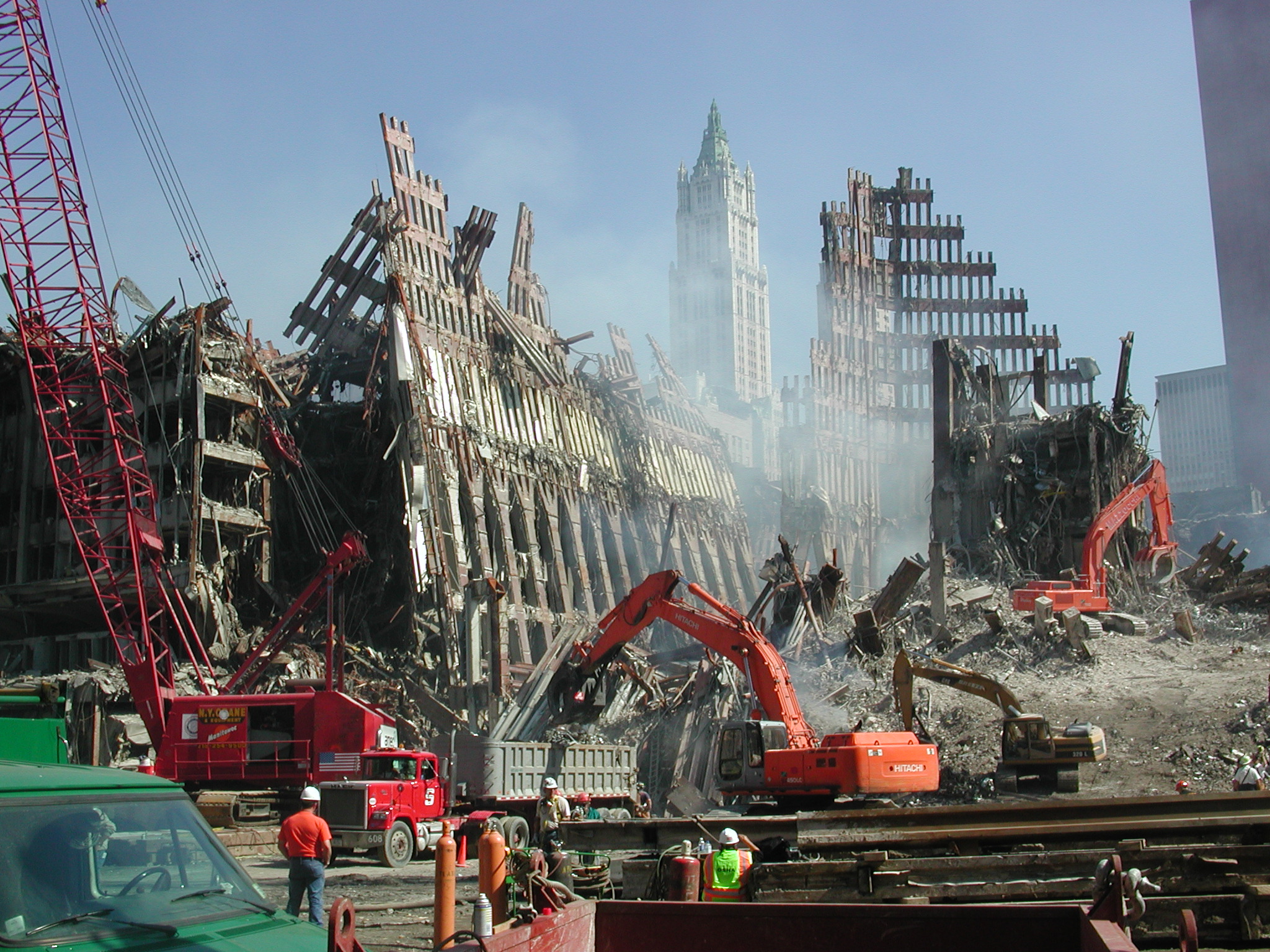
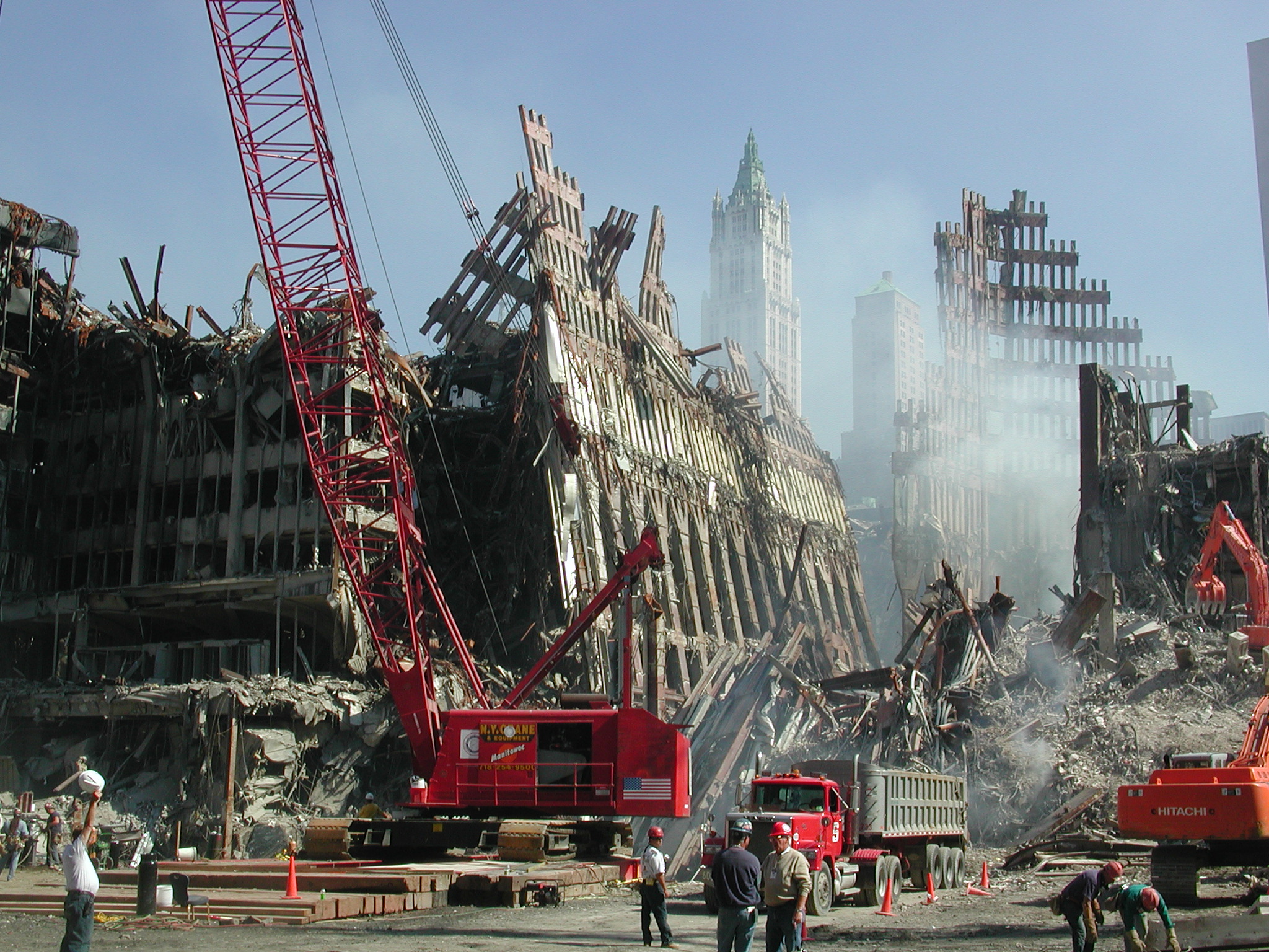
wtc021.jpg WTC. Tall creamy building beyond
is the historic Woolworth Building.
wtc022.jpg WTC, remnants of South Tower (map
2).
wtc023.jpg WTC, same.
wtc024.jpg WTC, same.
wtc025.jpg WTC, same.
wtc026.jpg WTC, remnants of Marriott Hotel
(map 3), South Tower behind.
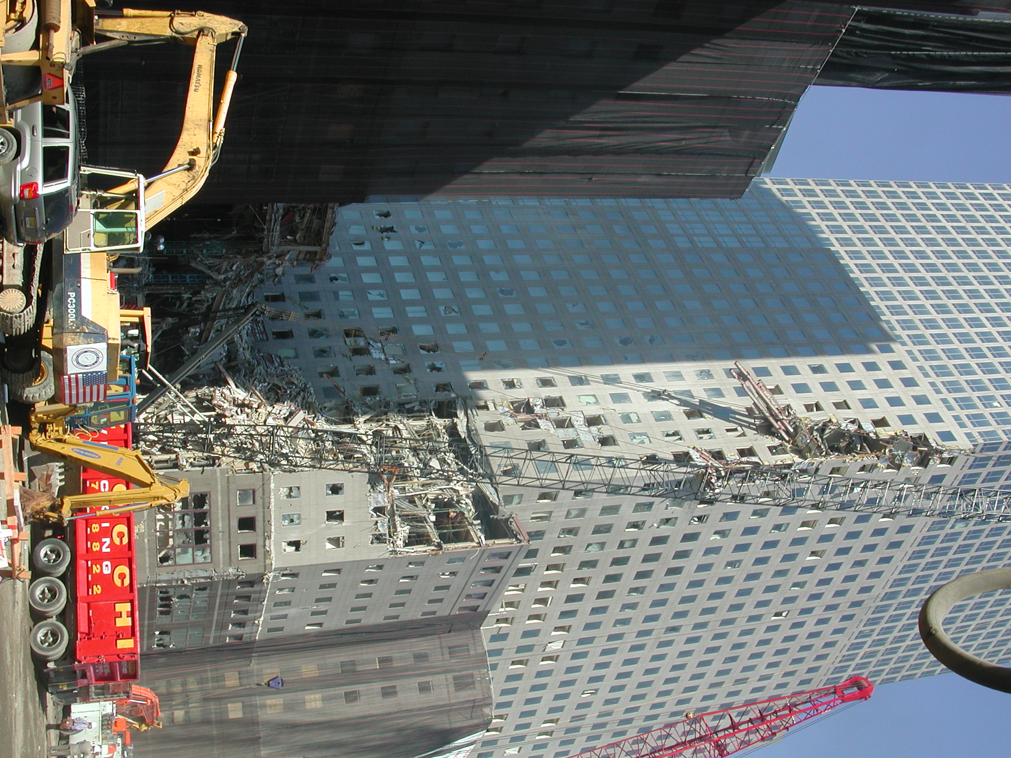
wtc027.jpg WFC, American Express (Amex),
showing parts of WTC embedded high on the
facade.
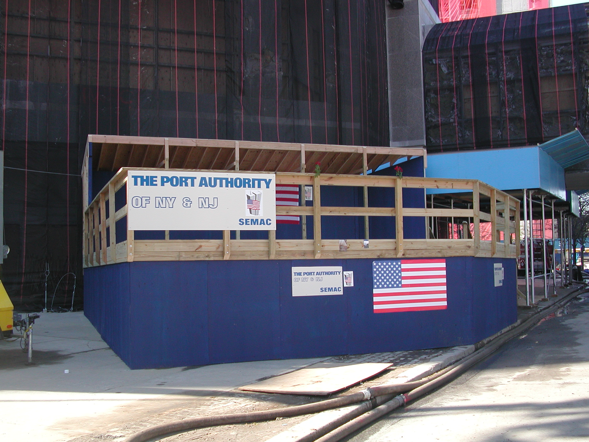
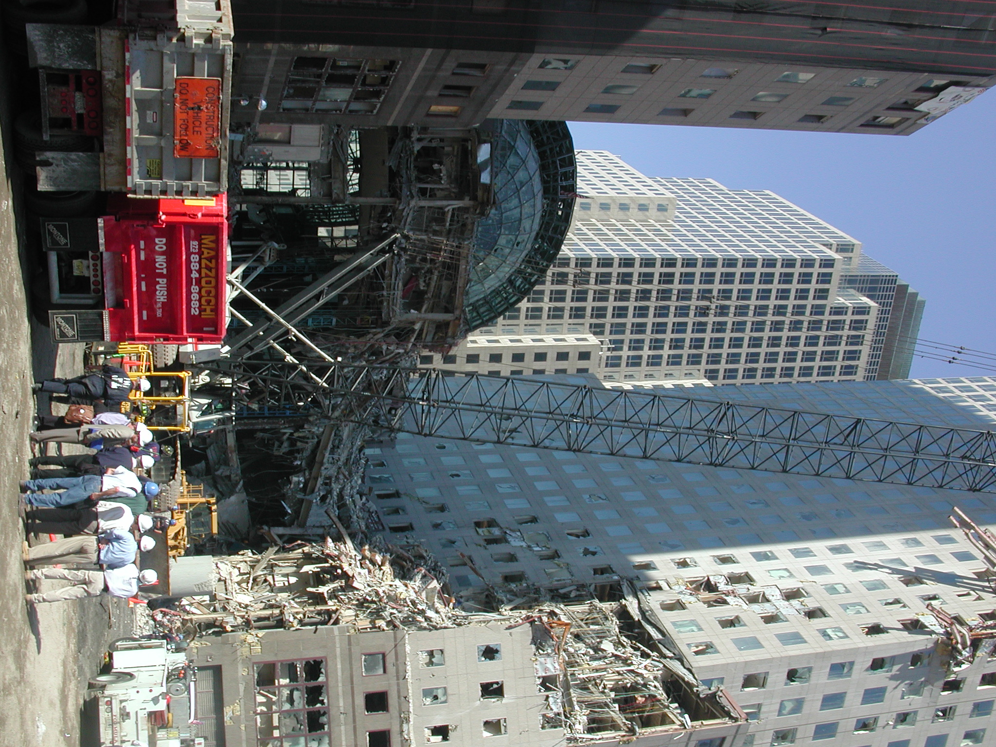
wtc028.jpg Port Authority Visitor Viewing
Stand.
wtc029.jpg WFC Bridge.
wtc030.jpg WTC, remnant of South Tower base
(map 2).
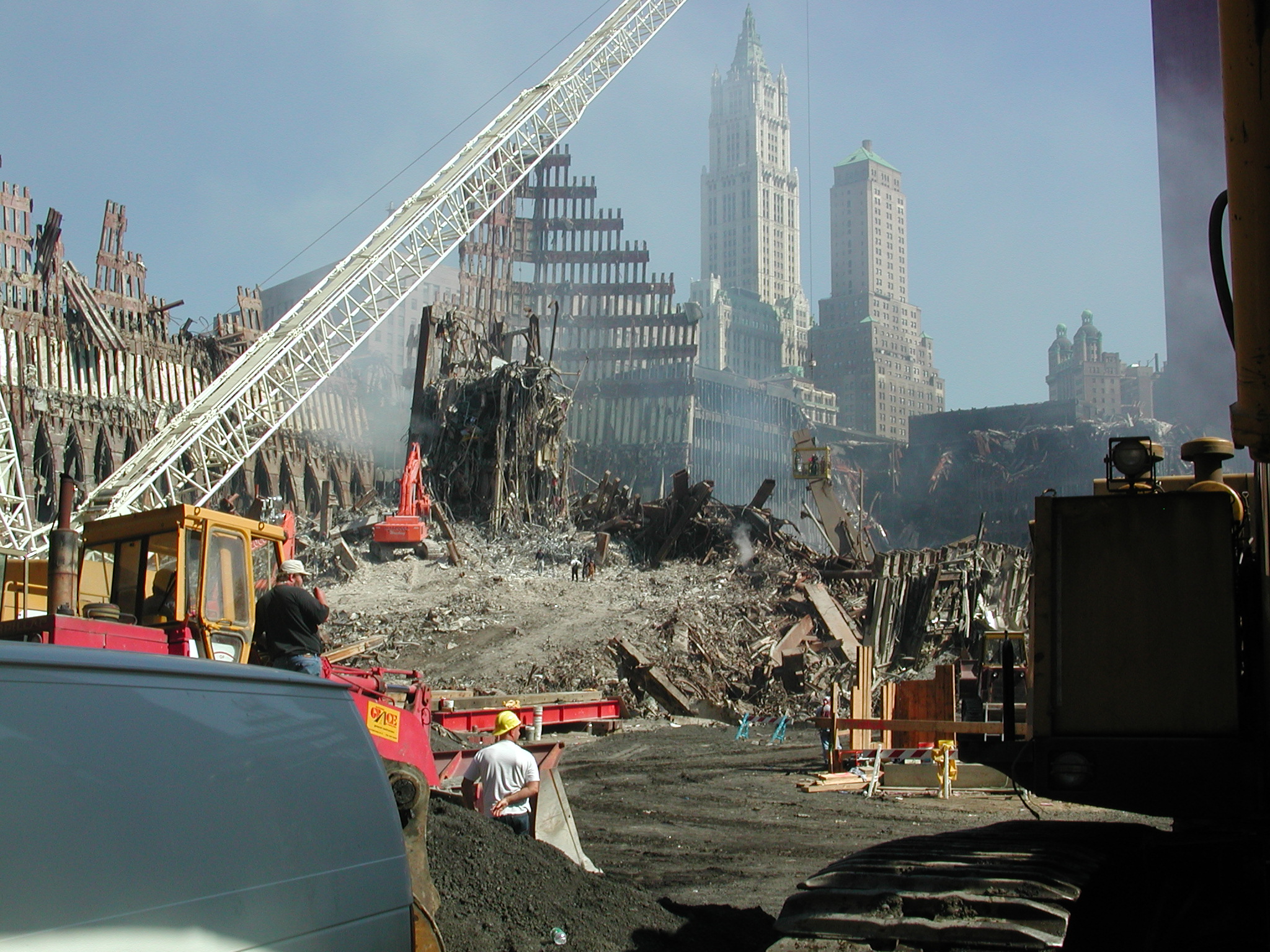
wtc031.jpg WTC. Tall creamy building beyond
is the historic Woolworth Building.
wtc032.jpg WTC, remnant of South Tower base
and Marriott hotel base (map 3) at right
forefront.
wtc033.jpg WTC, same.
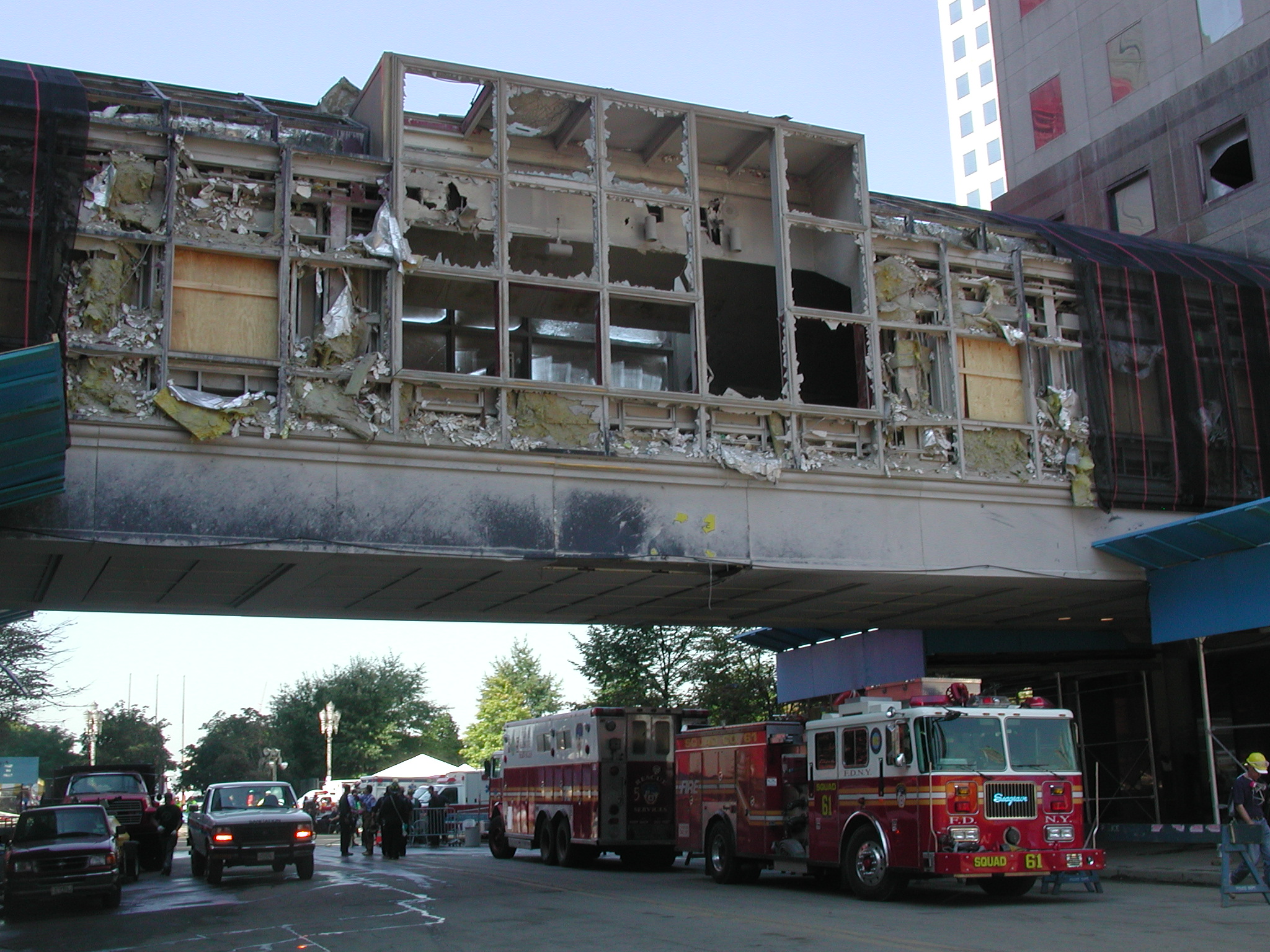
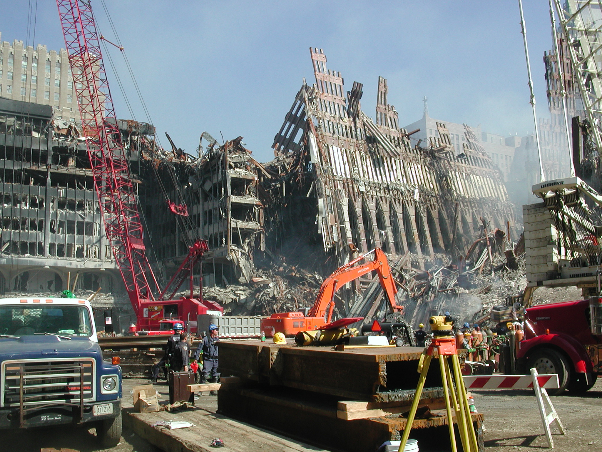
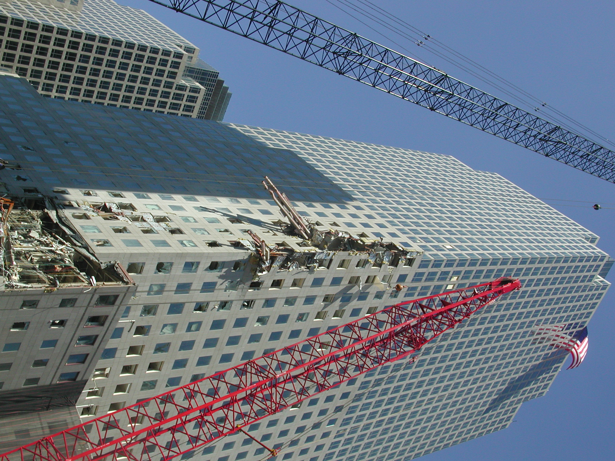
wtc034.jpg WTC. Dark facade beyond (map 20)
shows 17-story gash caused by South tower
collapse.
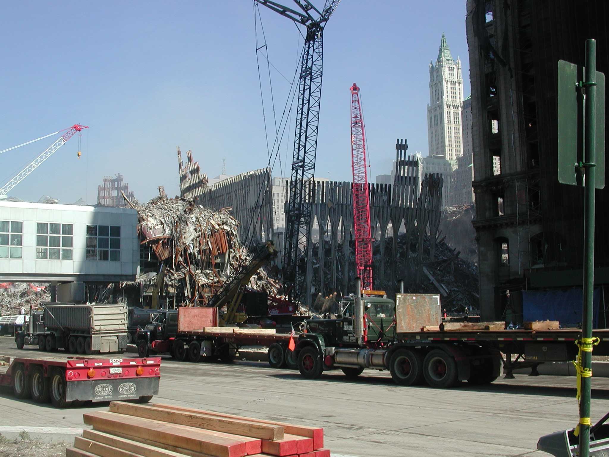
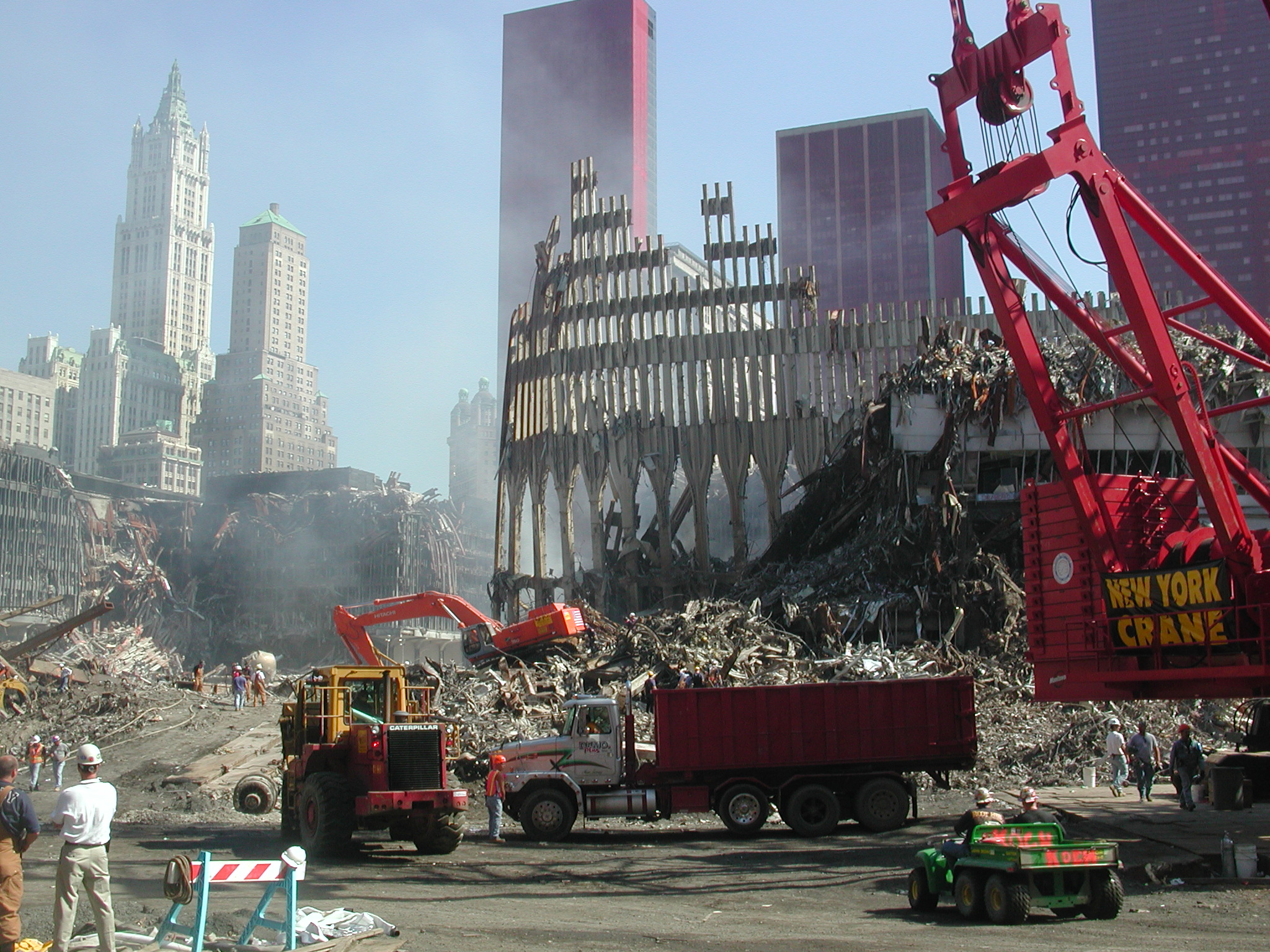
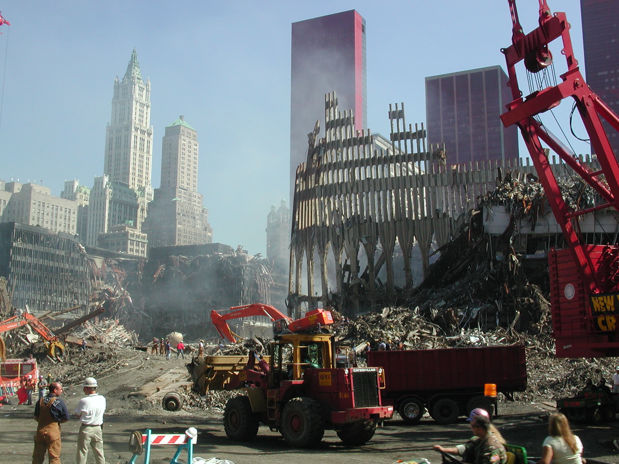
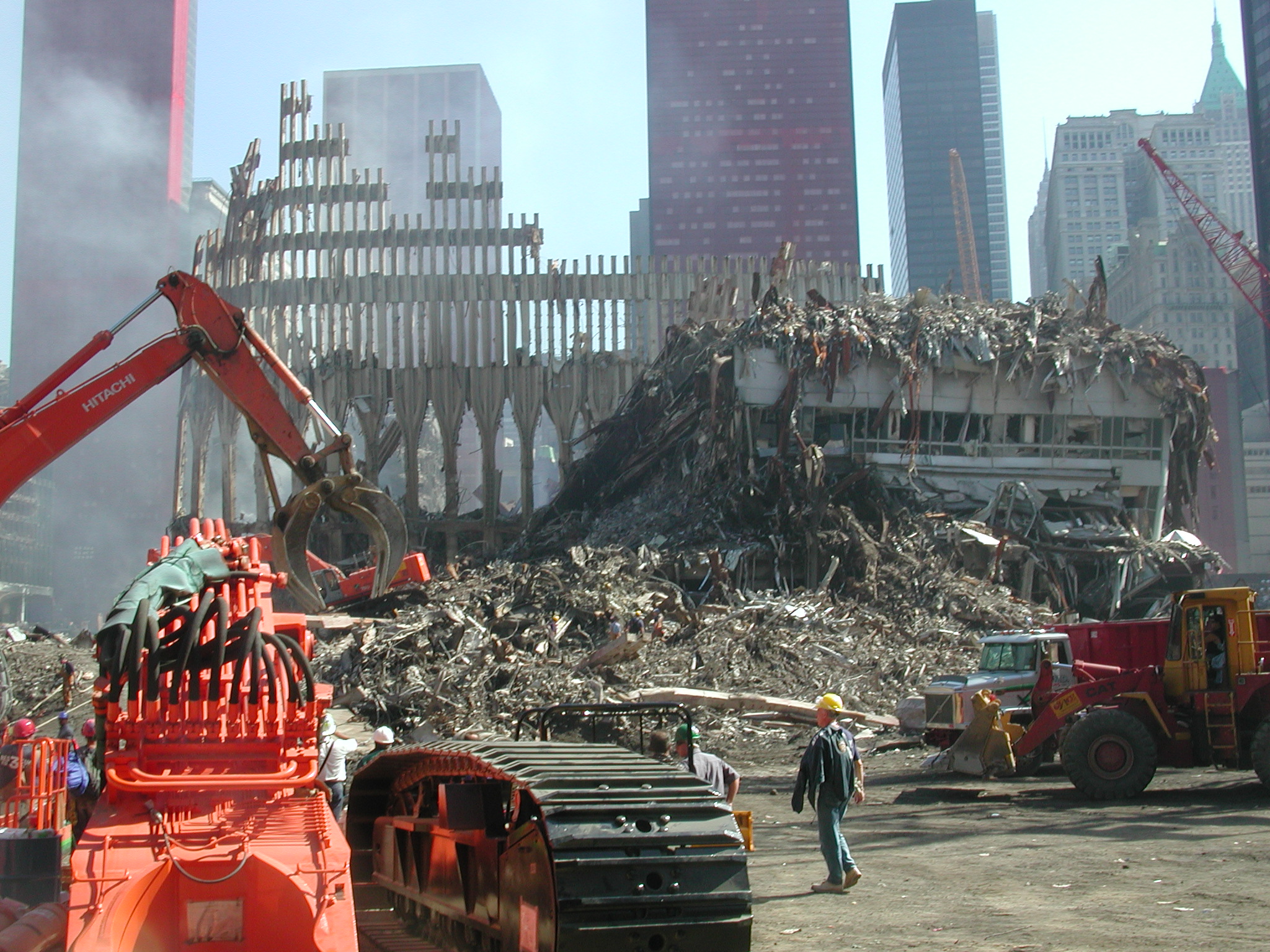
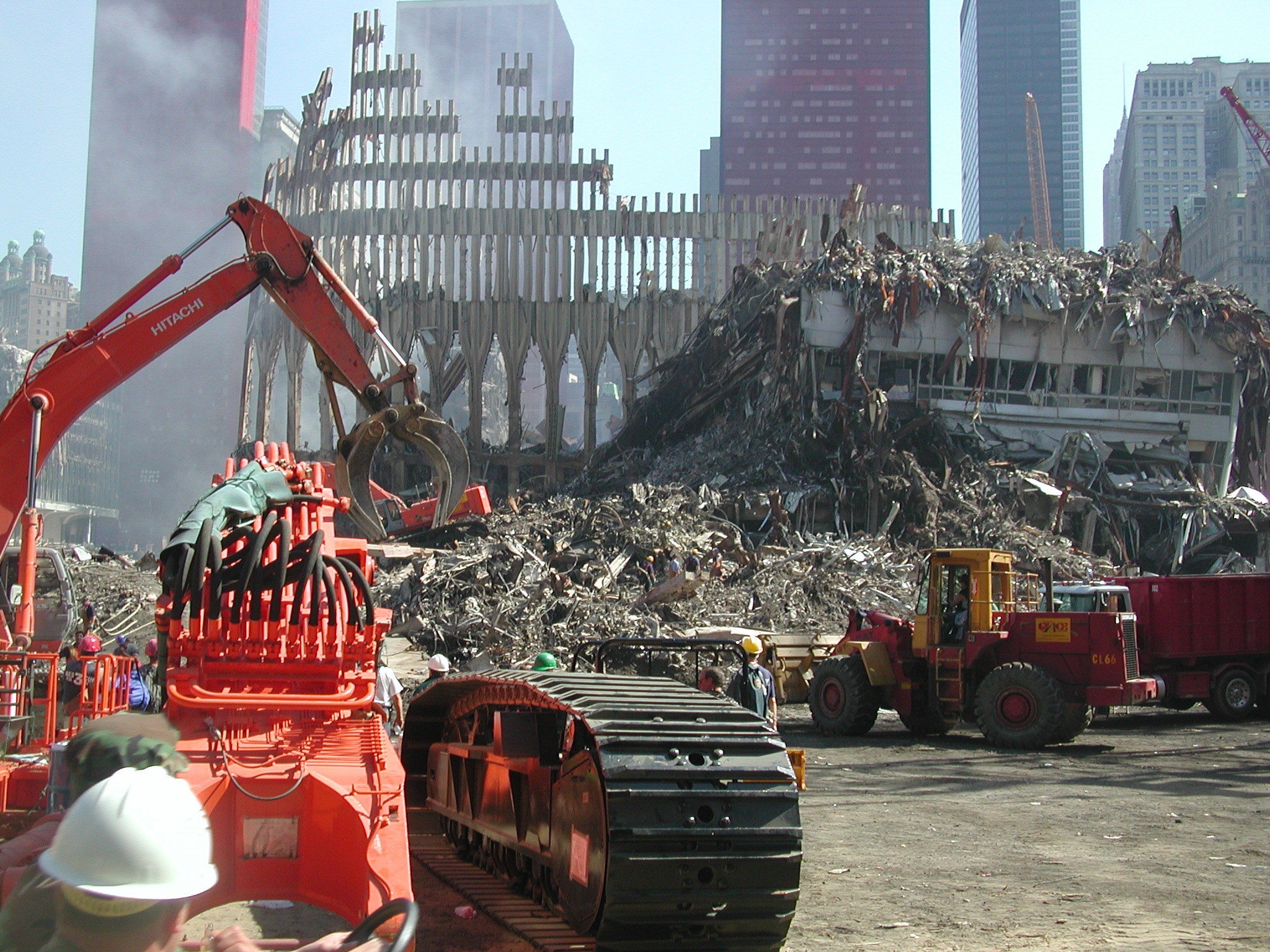
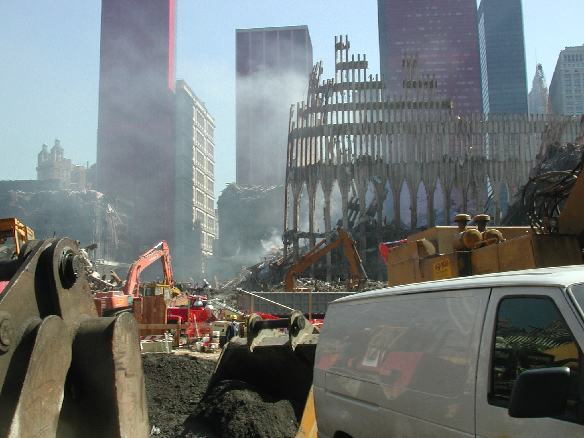
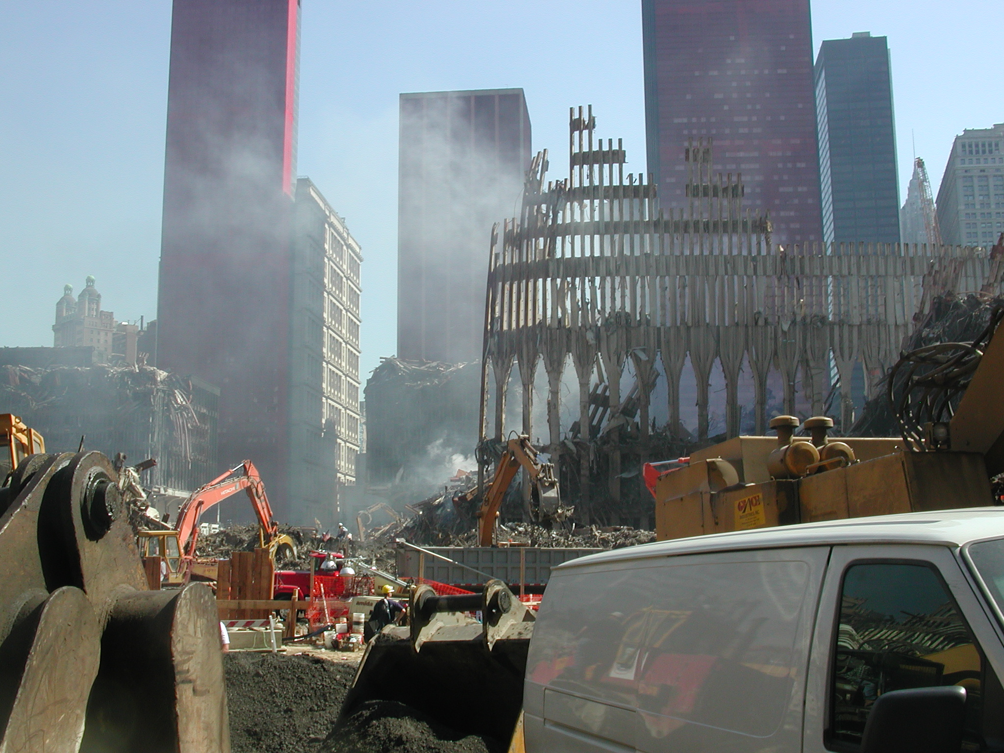
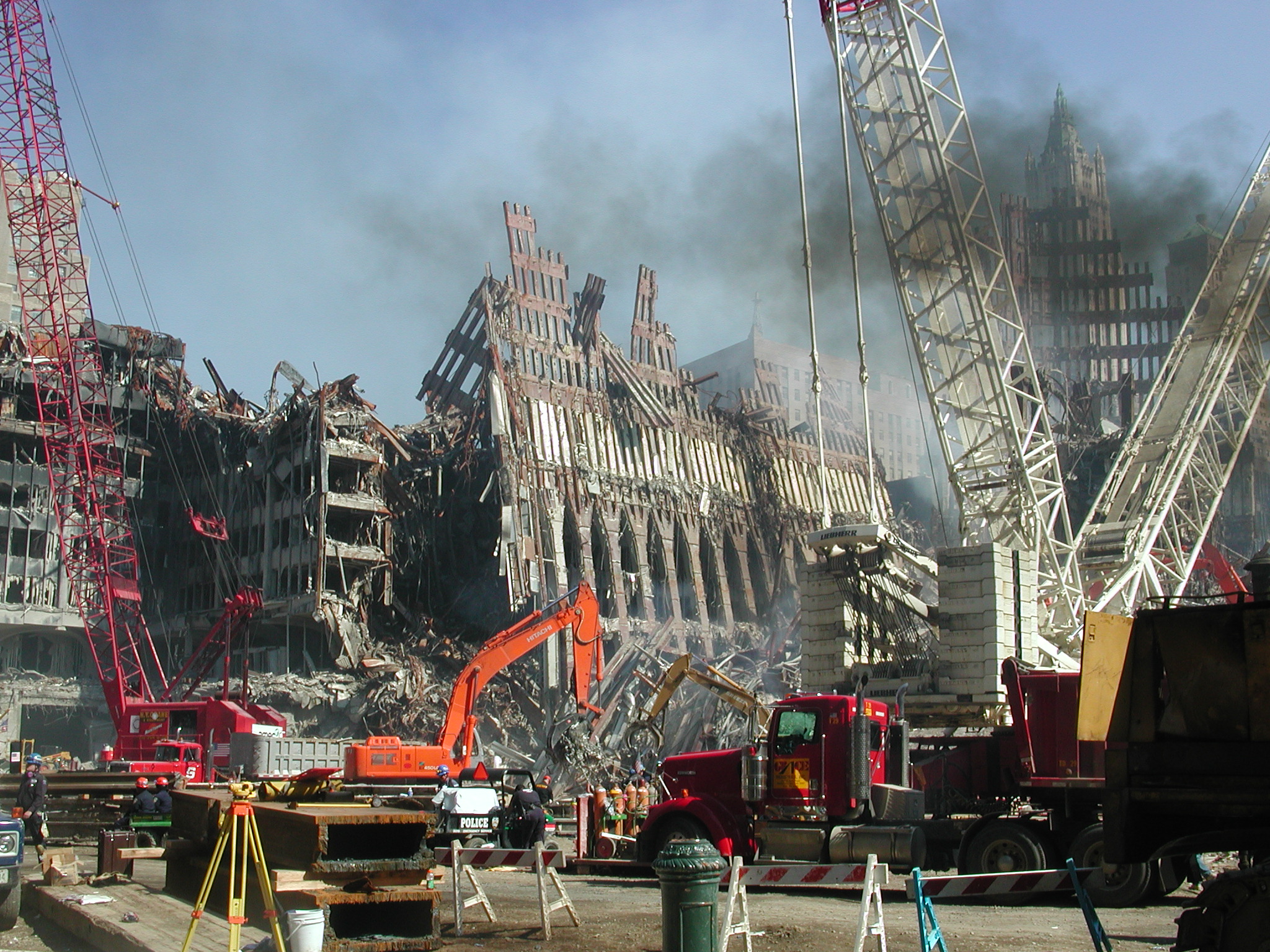
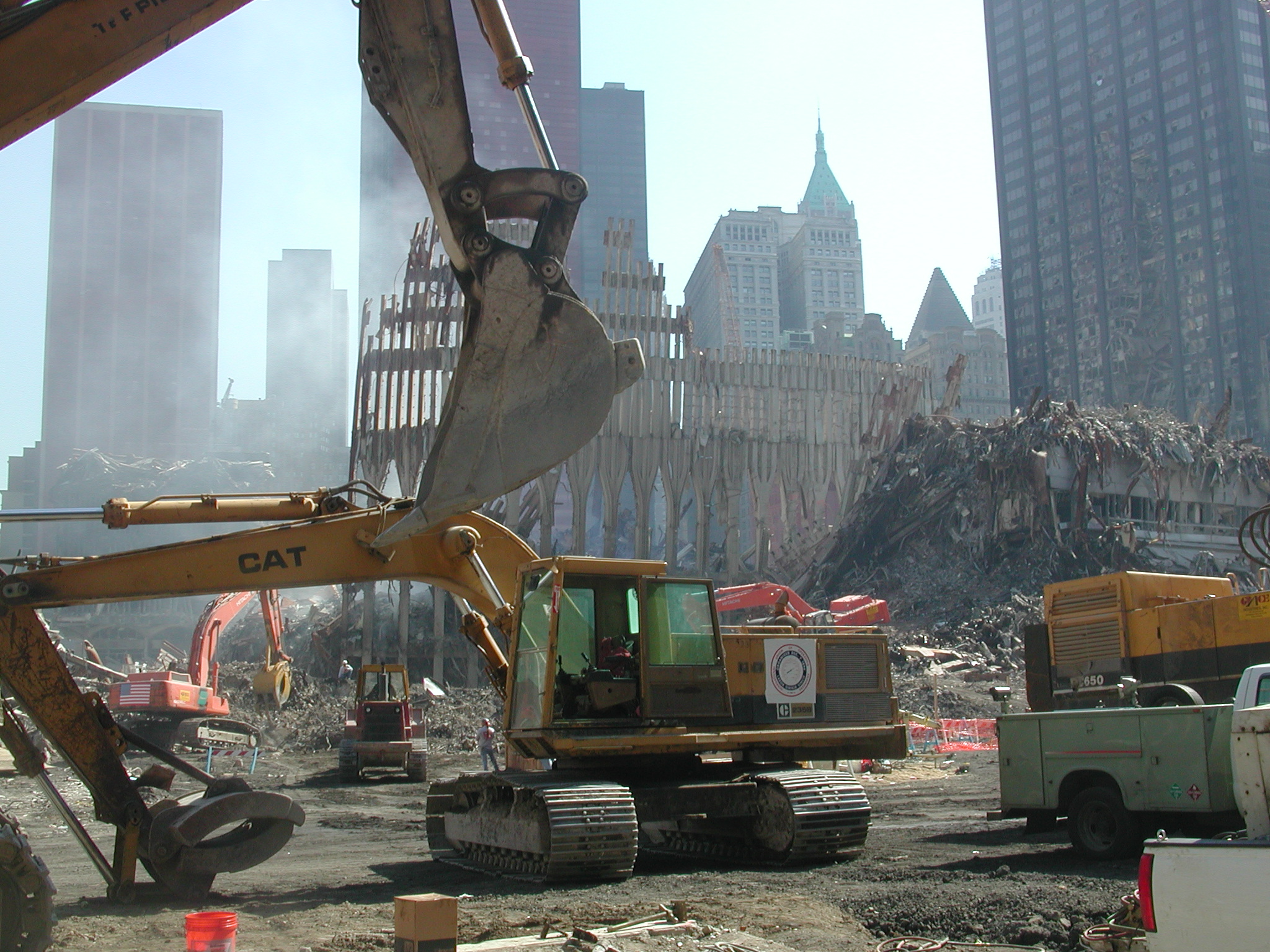
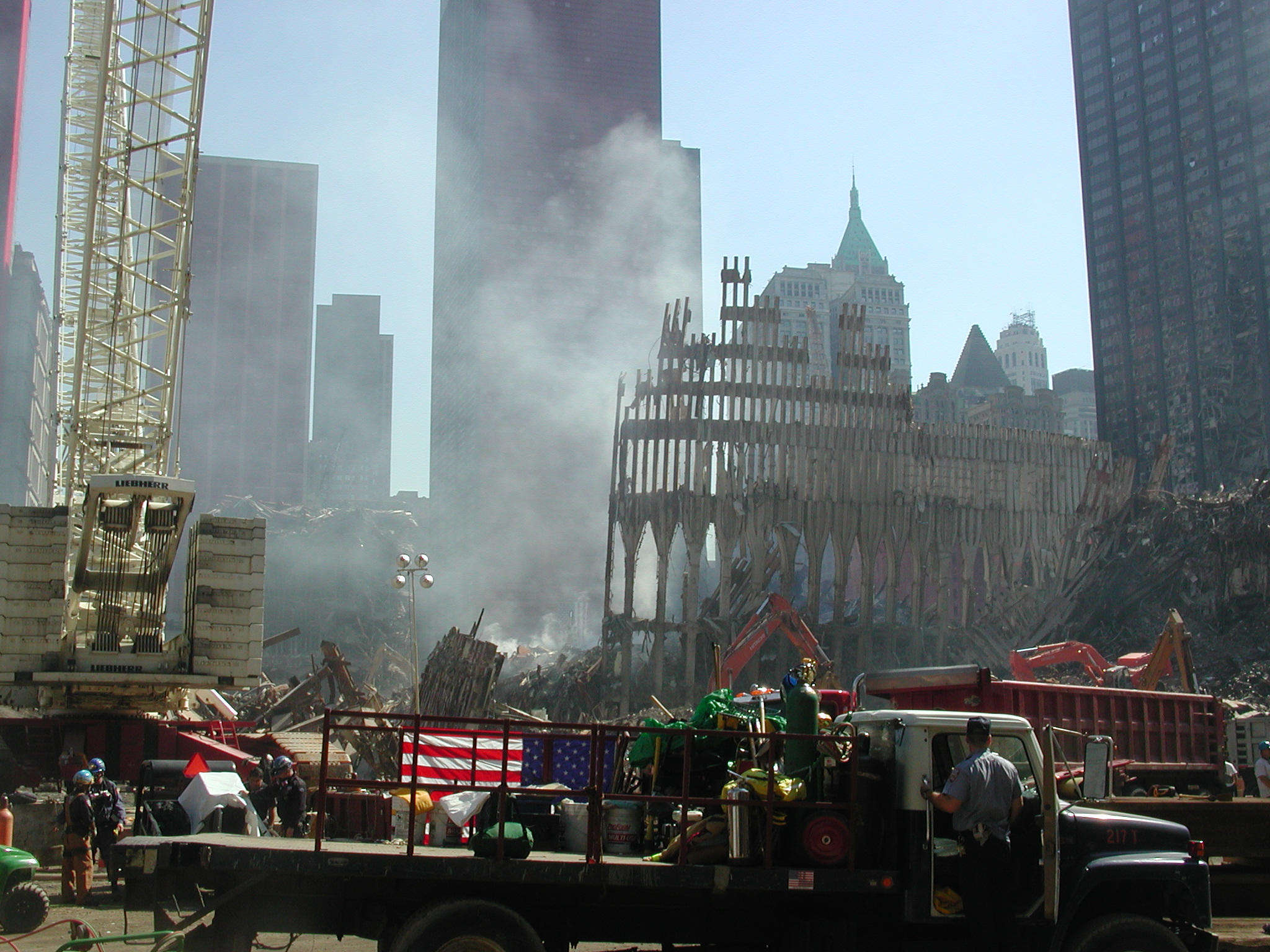
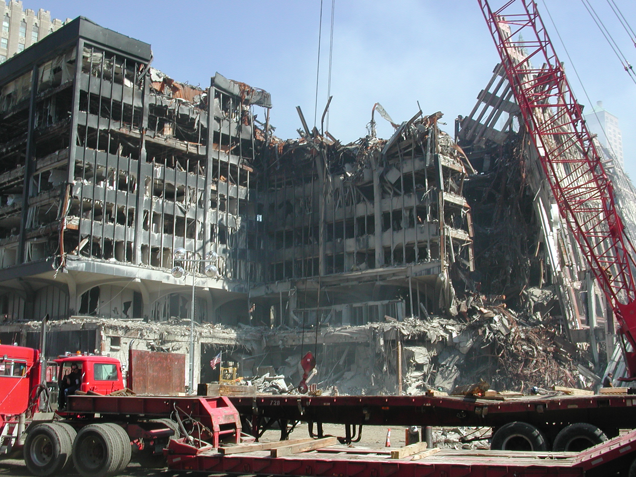
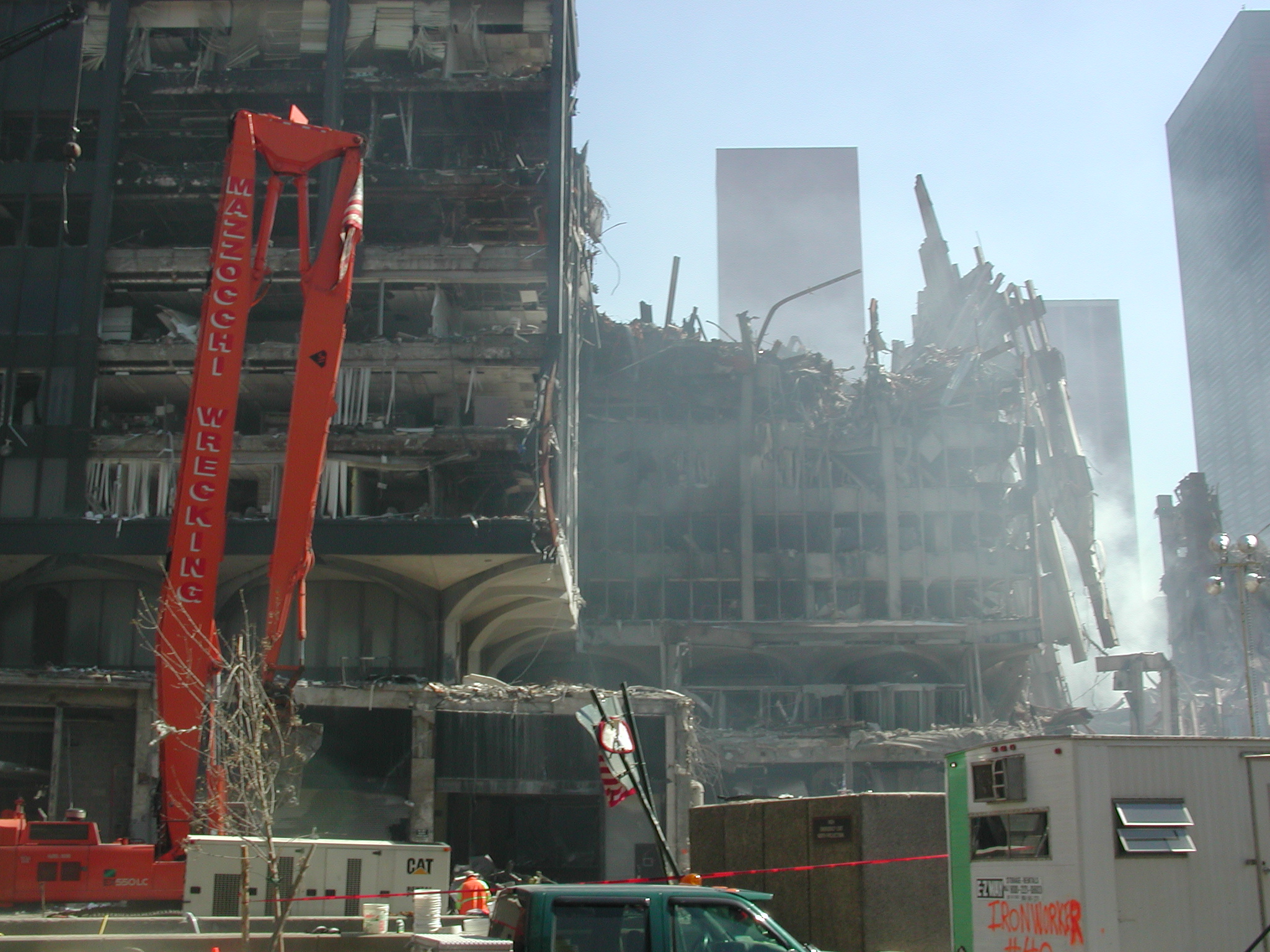
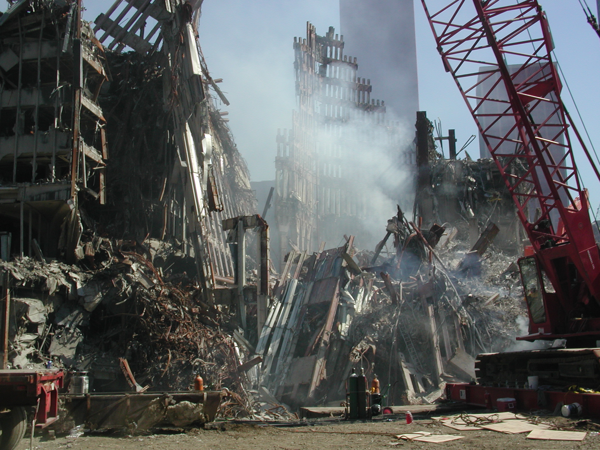
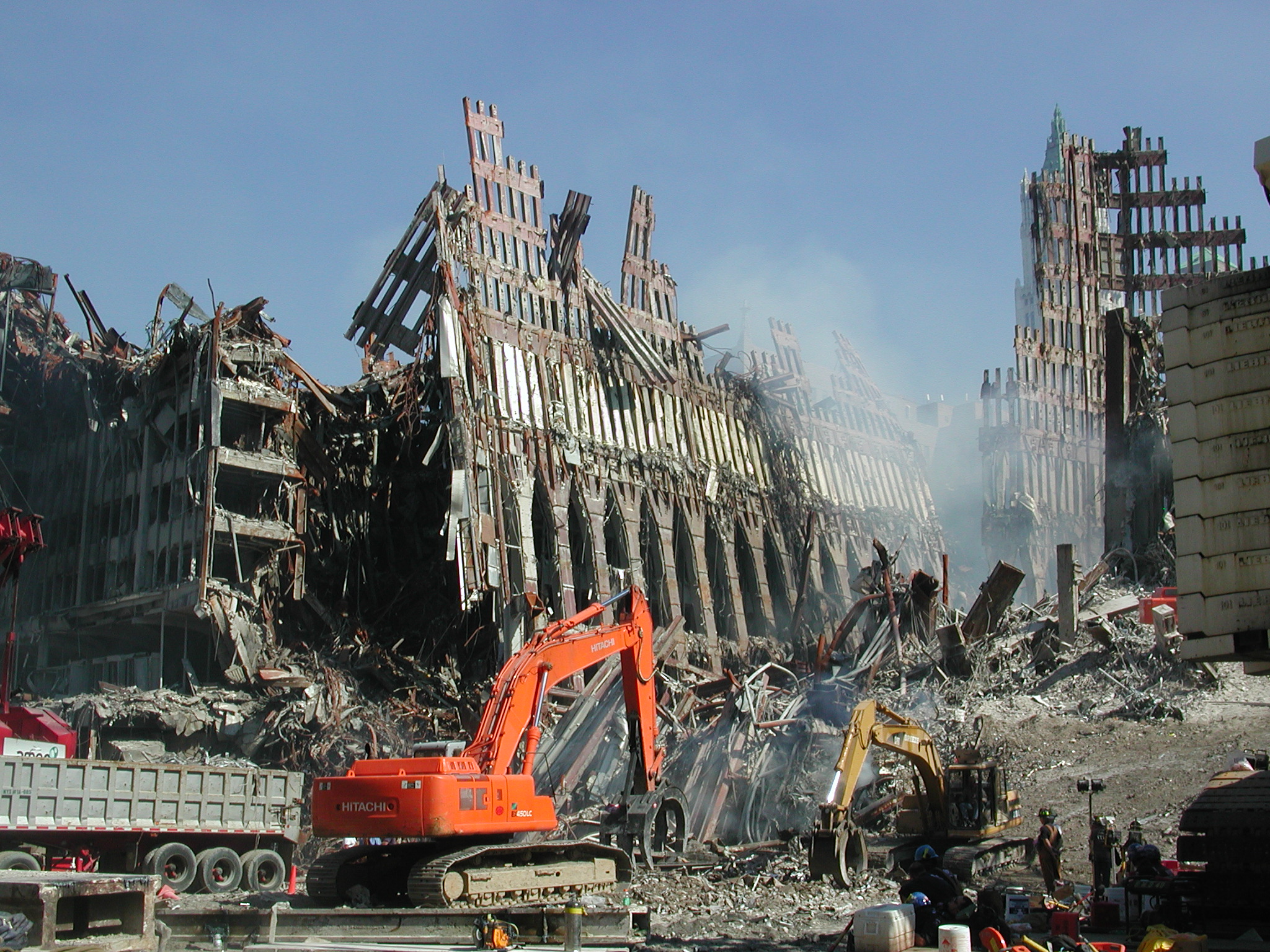
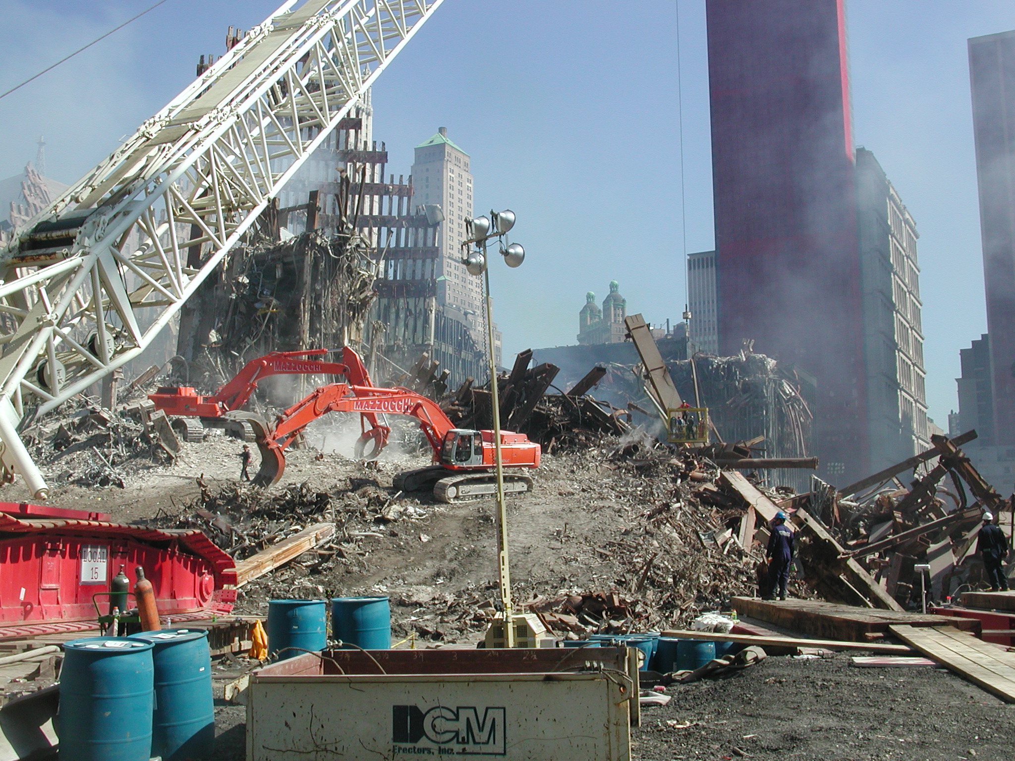
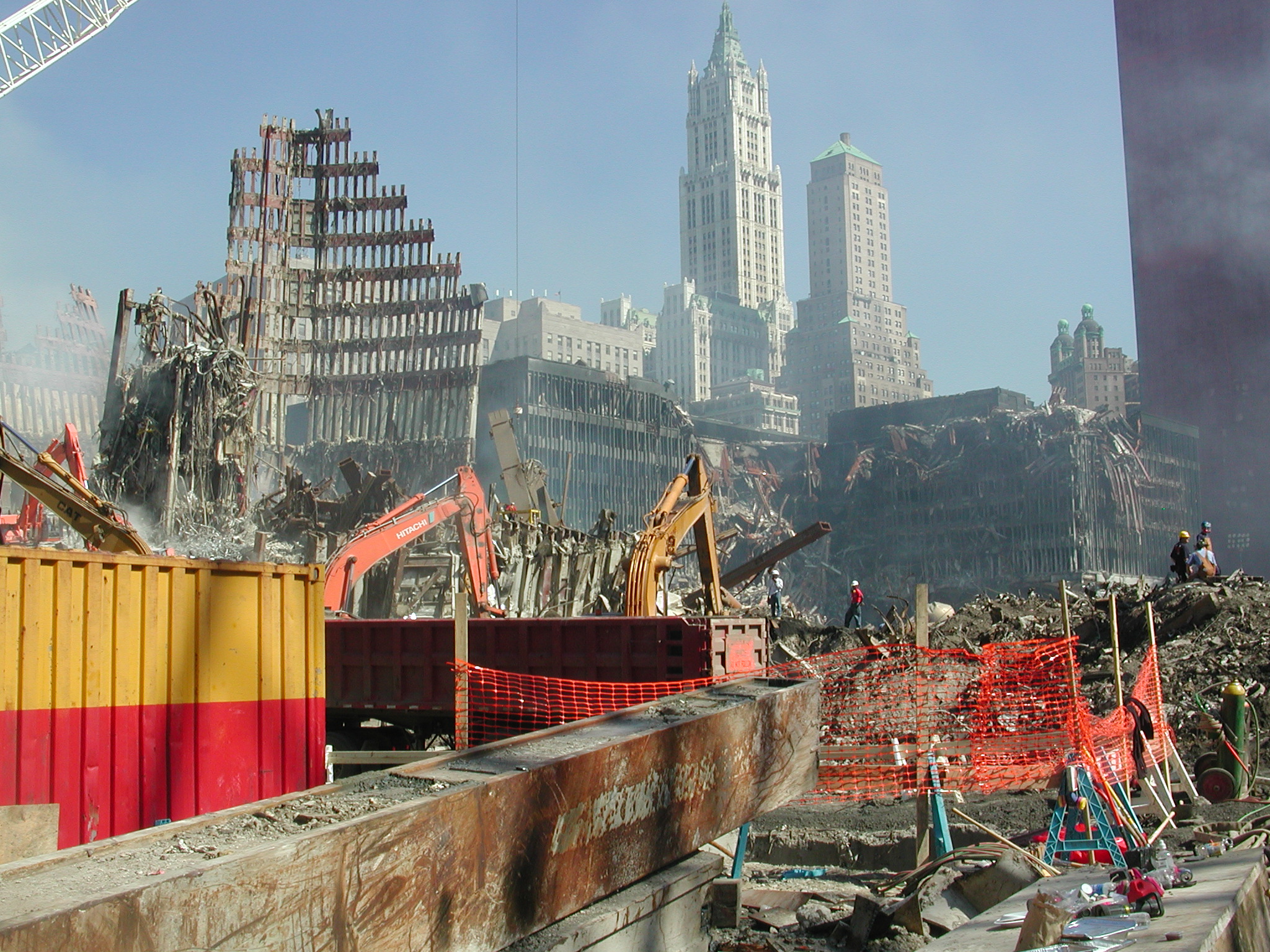
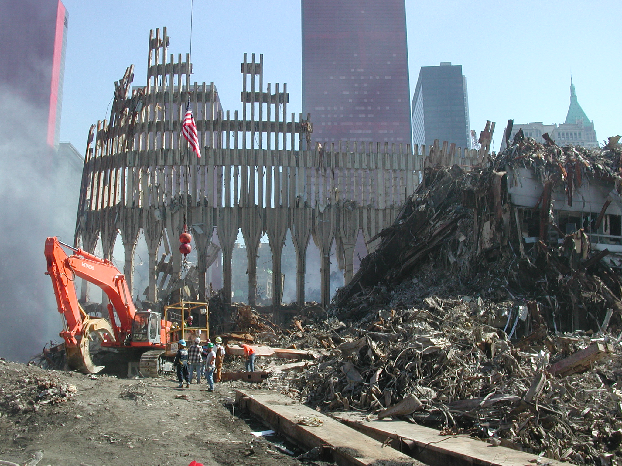
wtc035.jpg WTC, remnants of North Tower (map
1), with core at center.
wtc036.jpg WTC, remnants of South Tower (map
2), with 5 WTC at left in distance.
wtc037.jpg WTC, same.
wtc038.jpg WFC, Amex tower (map 14).
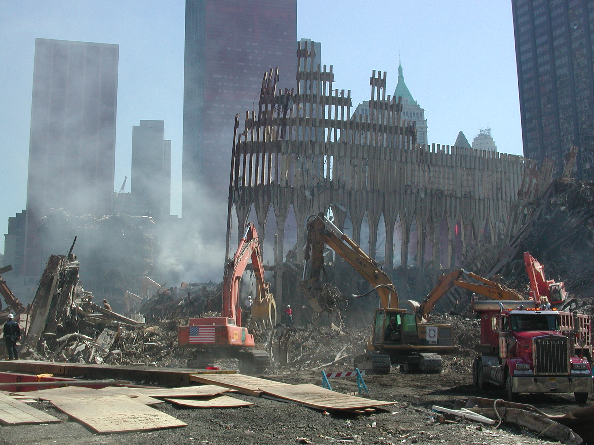
wtc039.jpg WTC, remnants of North Tower (map
1) and 6 WTC at left (map 6).
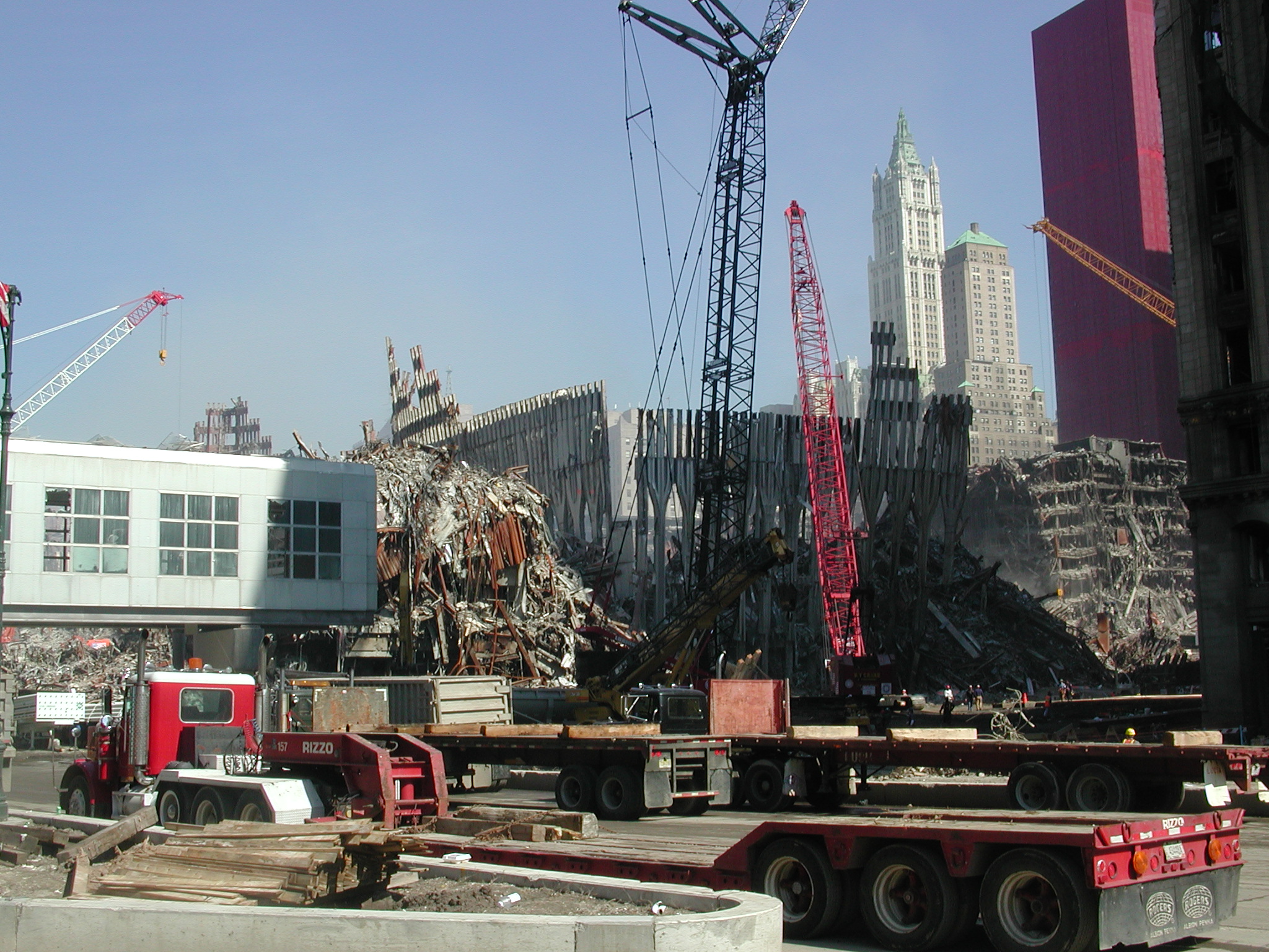
wtc040.jpg WTC, remnants of South Tower (map
2) and Marriott Hotel (map 3) at right.
wtc041.jpg WTC, remnants of North Tower (map
1) and 6 WTC at left (map 6).
wtc042.jpg WFC, Amex tower (map 14).
wtc043.jpg WTC, remnants of South Tower (map
2) and 4 WTC (map 4) in distance.
wtc044.jpg WTC, remnants of North Tower (map
1) and 6 WTC at left (map 6).
wtc045.jpg WTC, same.
wtc046.jpg WFC, Amex tower base, damaged
Wintergarden Pavilion at left.
wtc047.jpg WTC, remnants of North Tower (map
1). (partial photo)
[wtc048 not used]
wtc049.jpg WTC, remnants of South Tower (map
2) and 4 WTC (map 4) in distance. Looking
east, 180 degrees from photos 001 and 002.
wtc050.jpg WTC, 6 WTC (map 6)
wtc051.jpg End of walk north.
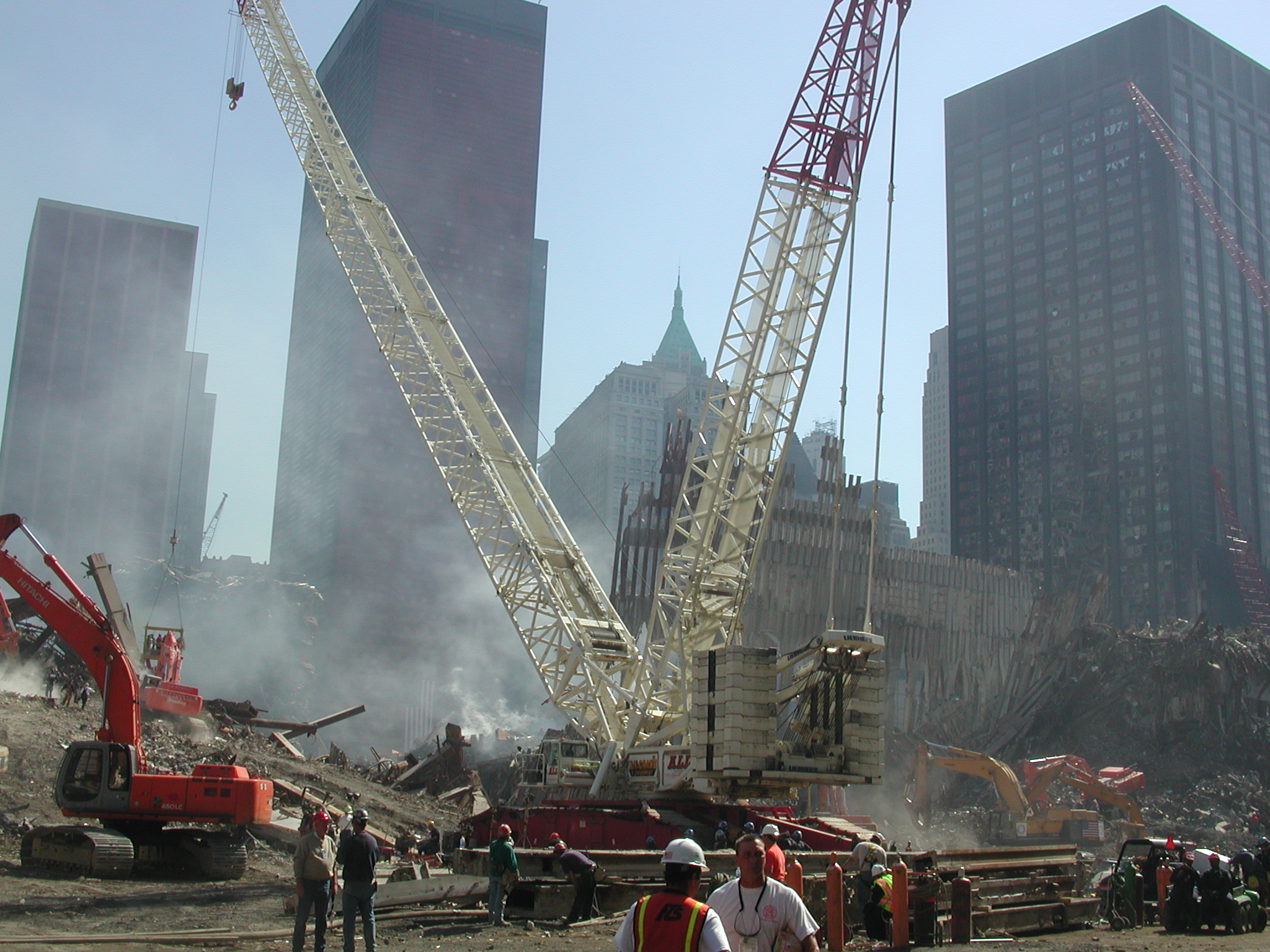
From West Side Highway, walking south:
wtc052.jpg WFC, base of Amex tower (map
14).
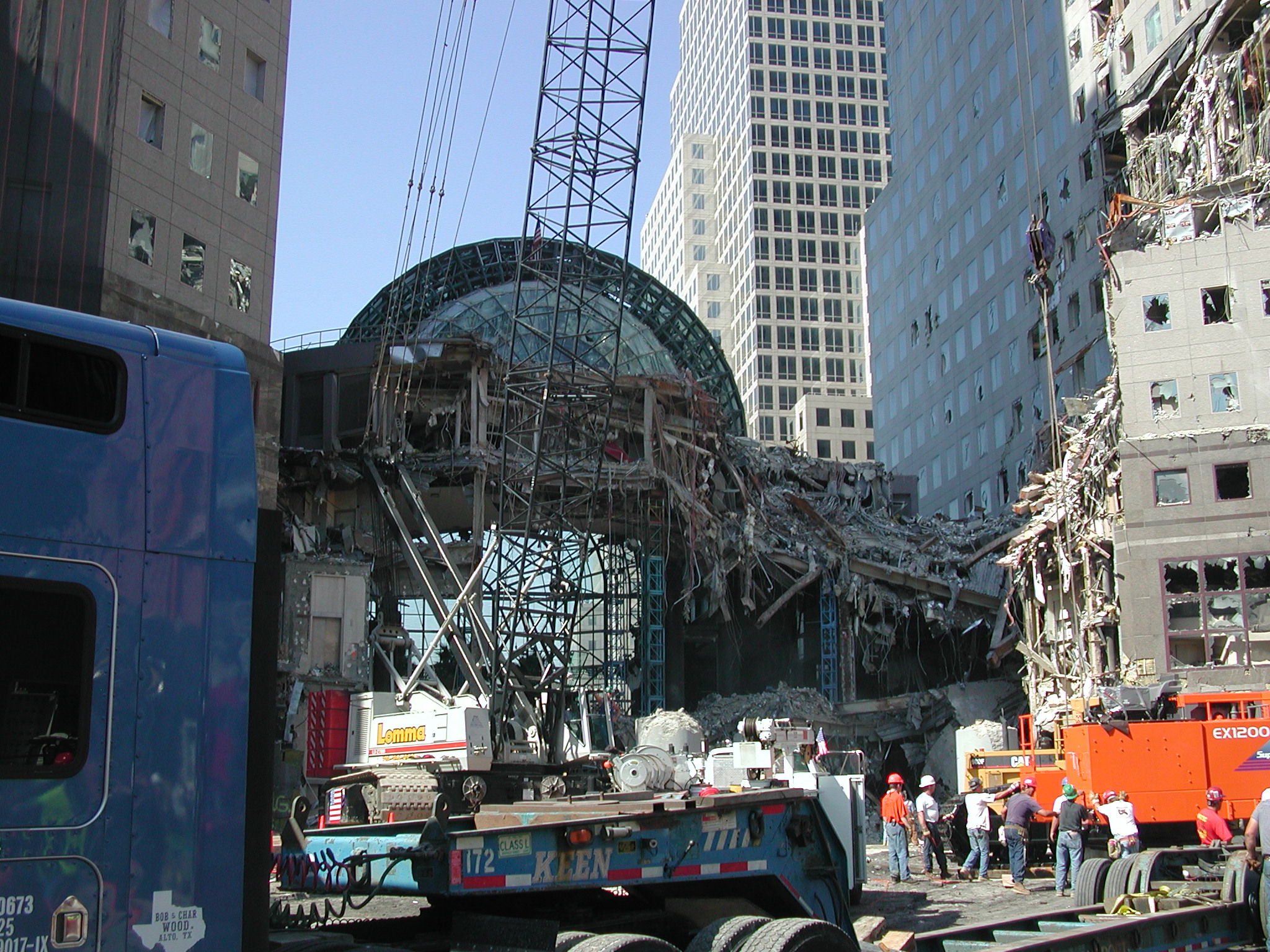
wtc053.jpg WFC, Wintergarden Pavilion adjacent
to Amex tower.
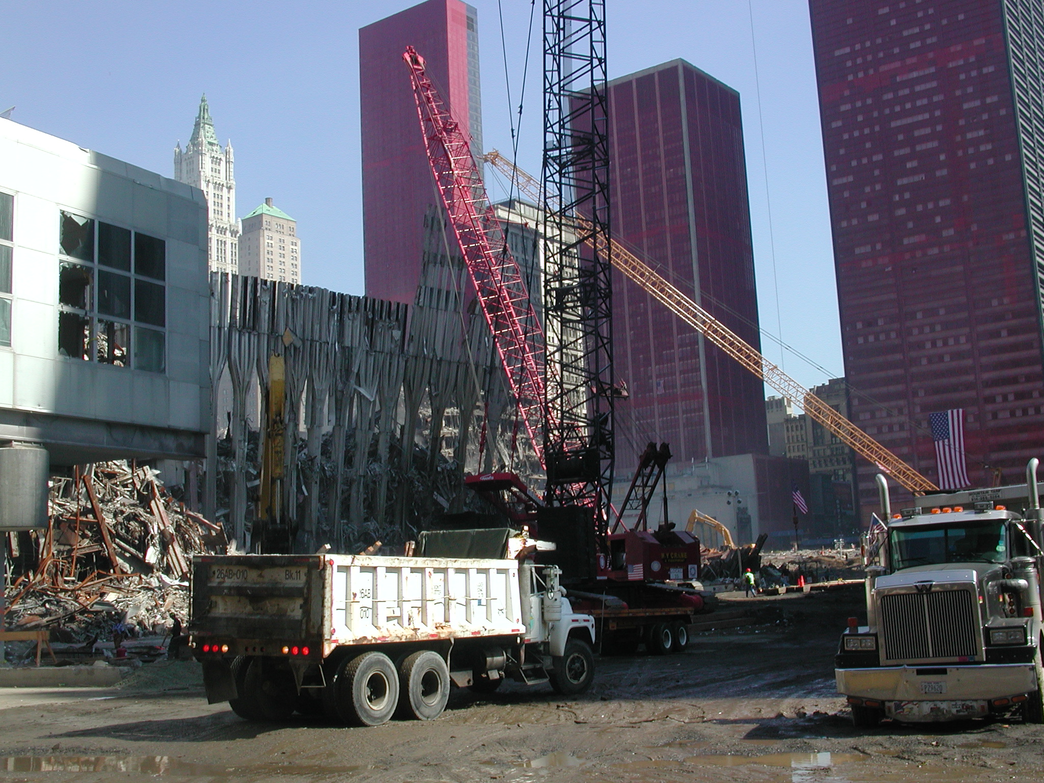
wtc054.jpg WFC, Amex tower (map 14).
wtc055.jpg WTC, remnants of Marriott Hotel
(map 3), bridge at right to WFC (map 16)
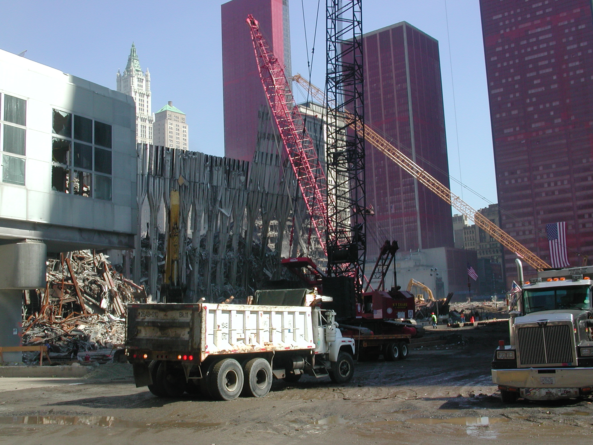
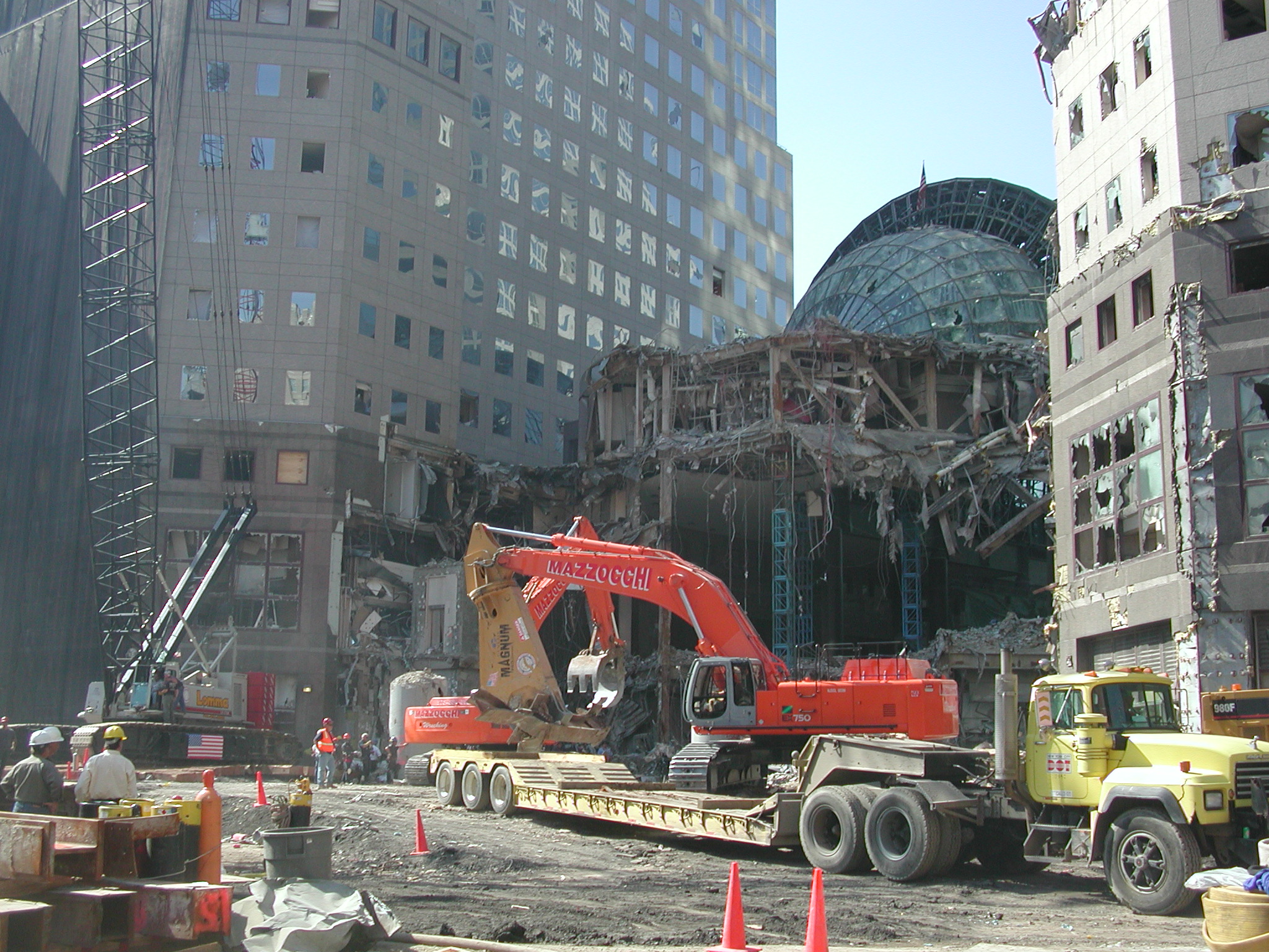
wtc056.jpg WFC, Amex tower base, Wintergarden
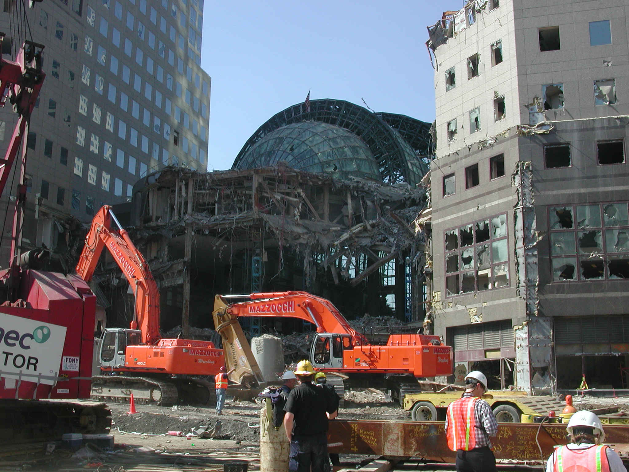
Pavilion.
wtc057.jpg WFC, Amex tower base, Wintergarden
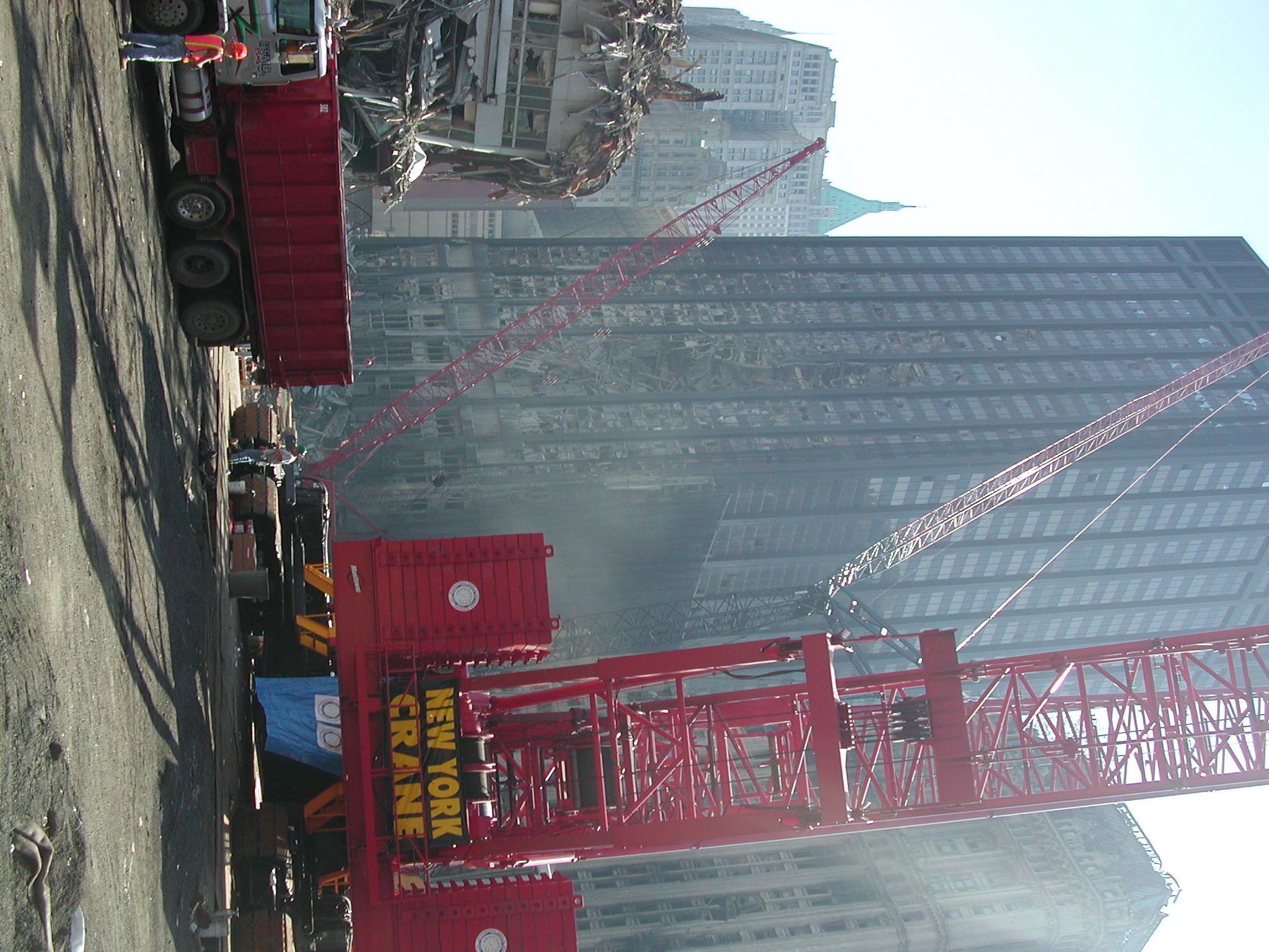
Pavilion. Large crane being assembled.
wtc058.jpg WTC, 6 World Trade Center (map
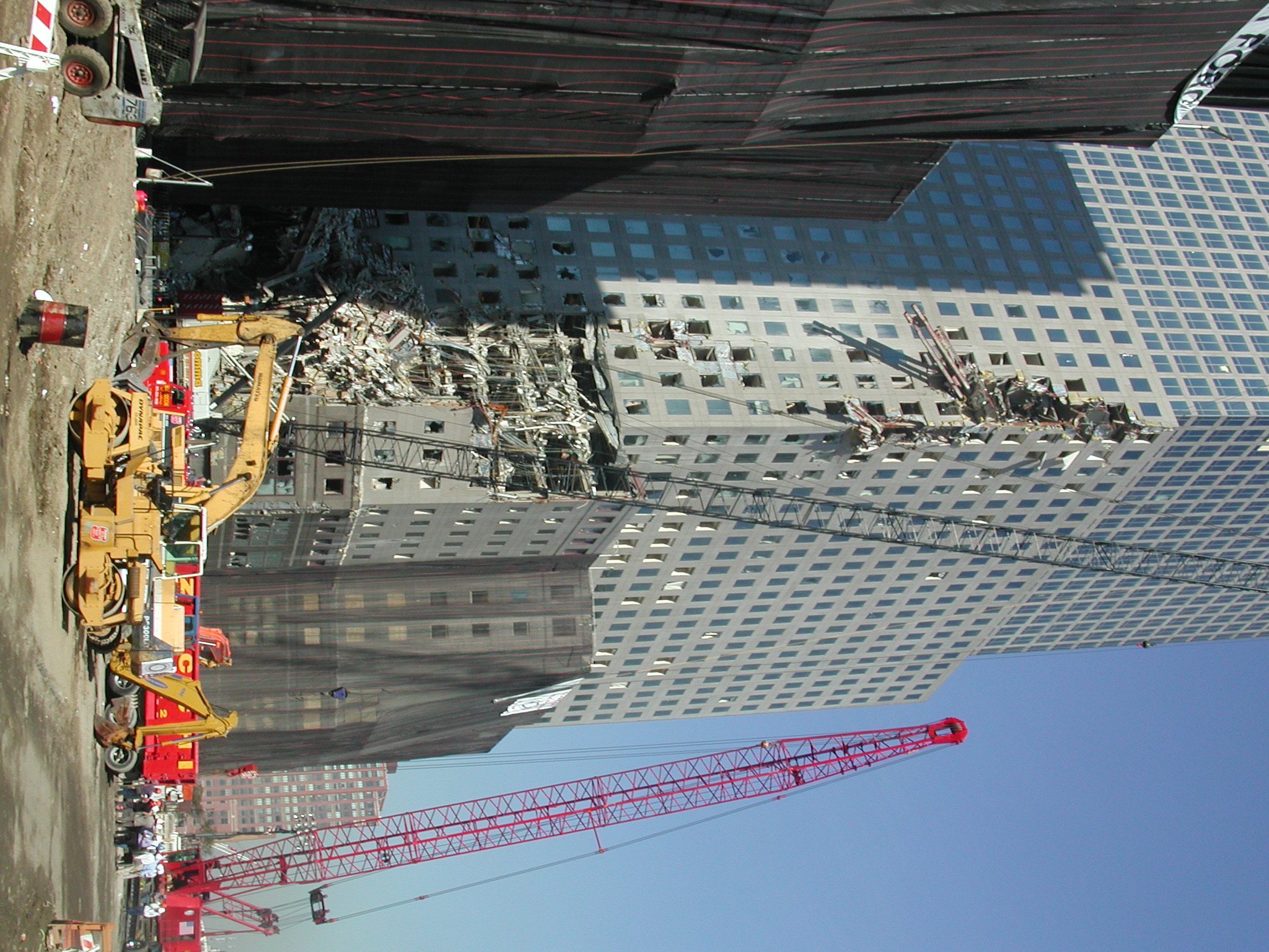
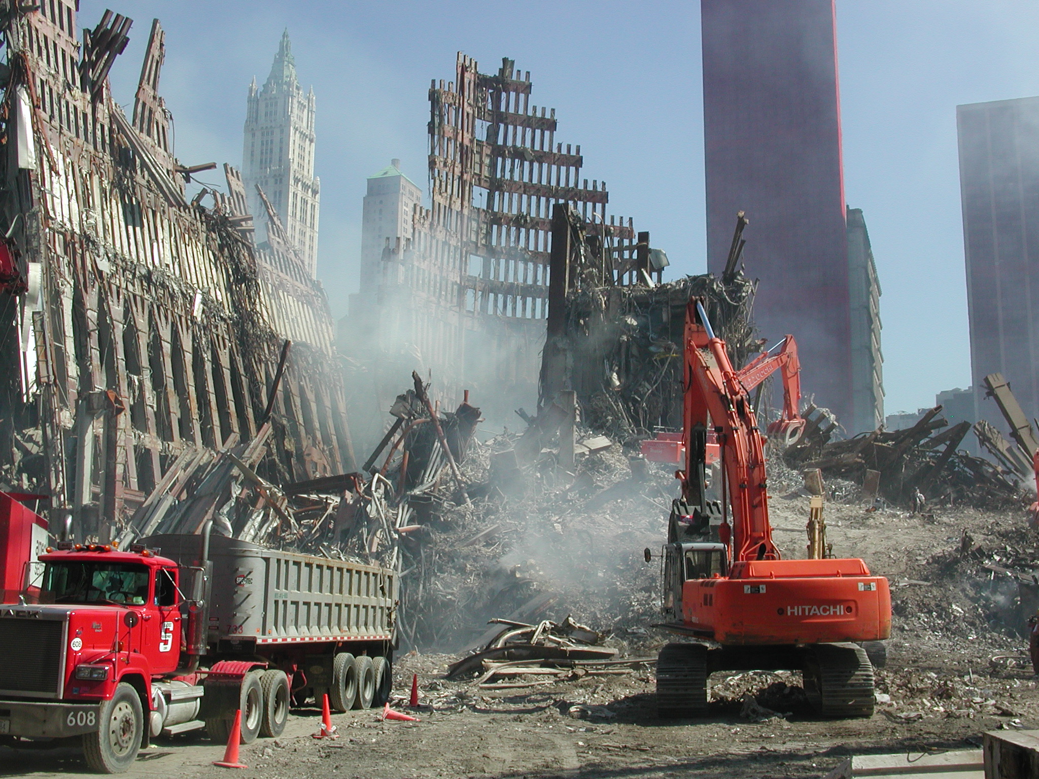
6).
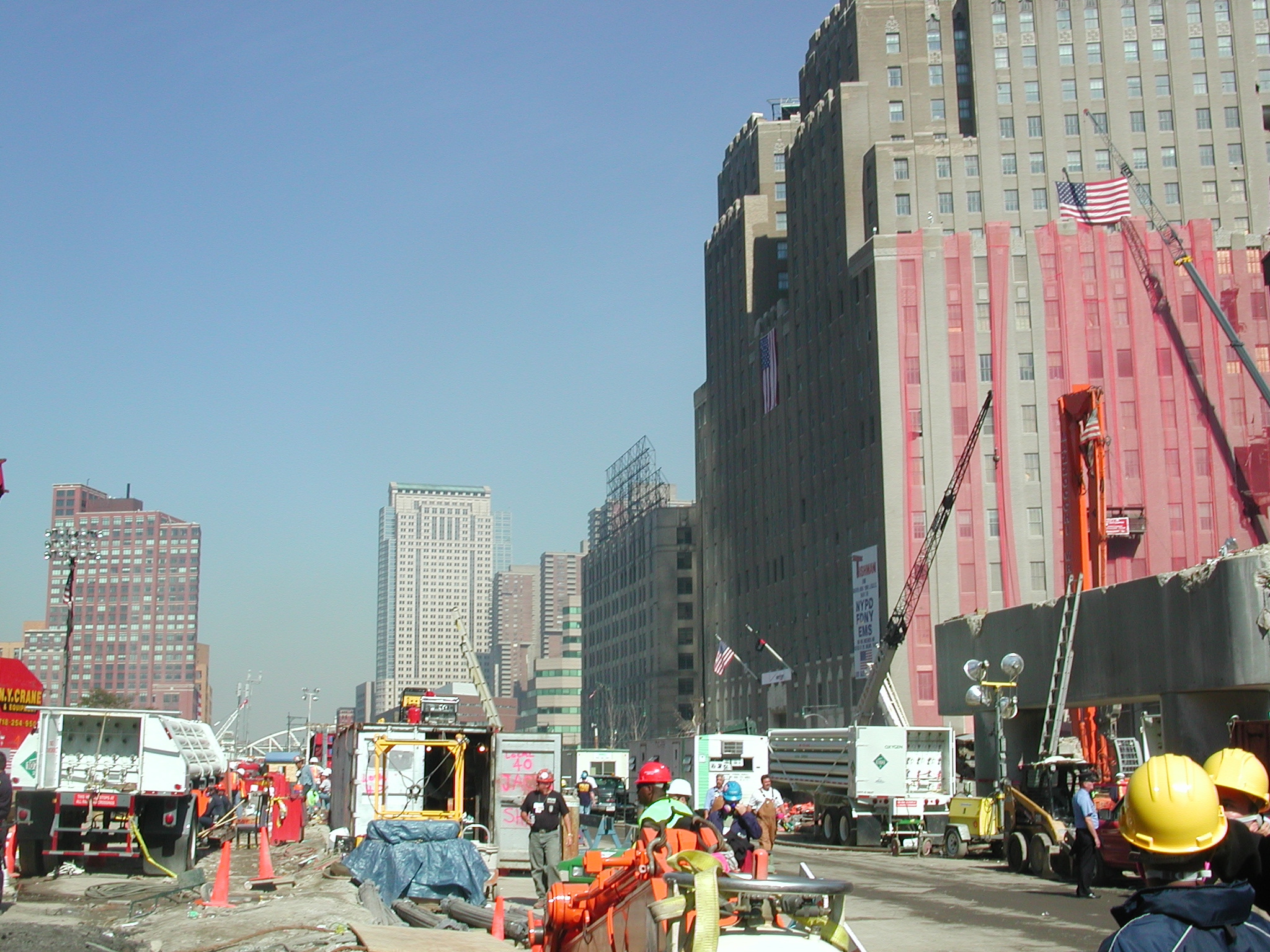
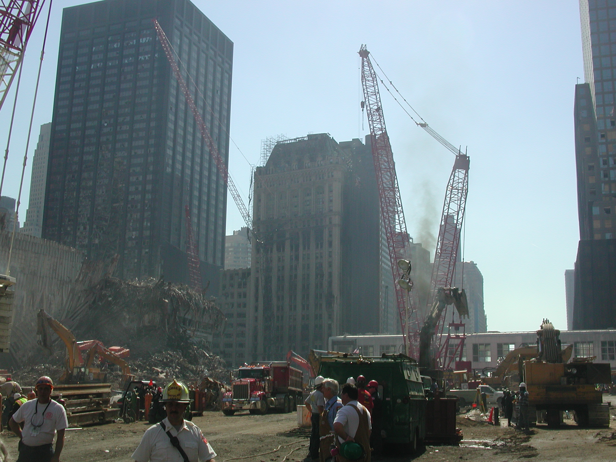
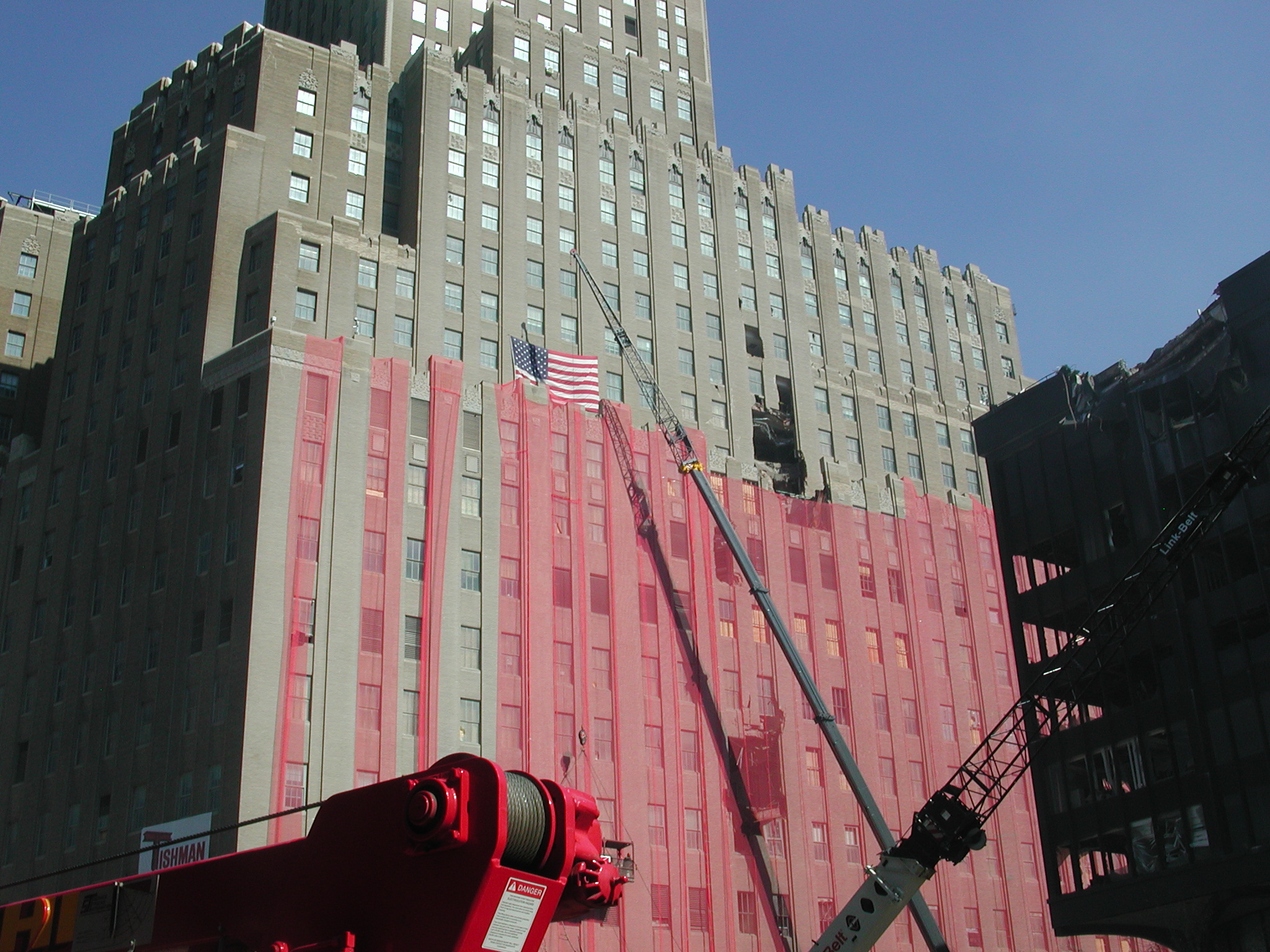
wtc059.jpg (Map 13) New York Times (10-07-01):
"The Barclay-Vesey Building, owned by
Verizon, sustained facade damage and has thousands of blown-out windows.
'Beams went through the seventh-floor walls and ended up in the basement,'
said
Frank McLaughlin, a Verizon spokesman. 'It's like big arrows were shot
into it.' "
wtc060.jpg WTC, 6 WTC (map 6) at left, South
Tower in distance (map 2).
wtc061.jpg WTC, remains of 6 World Trade
Center (map 6).
wtc062.jpg WTC, same.
wtc063.jpg WTC, same.
wtc064.jpg WTC, same.
wtc065.jpg WTC, same.
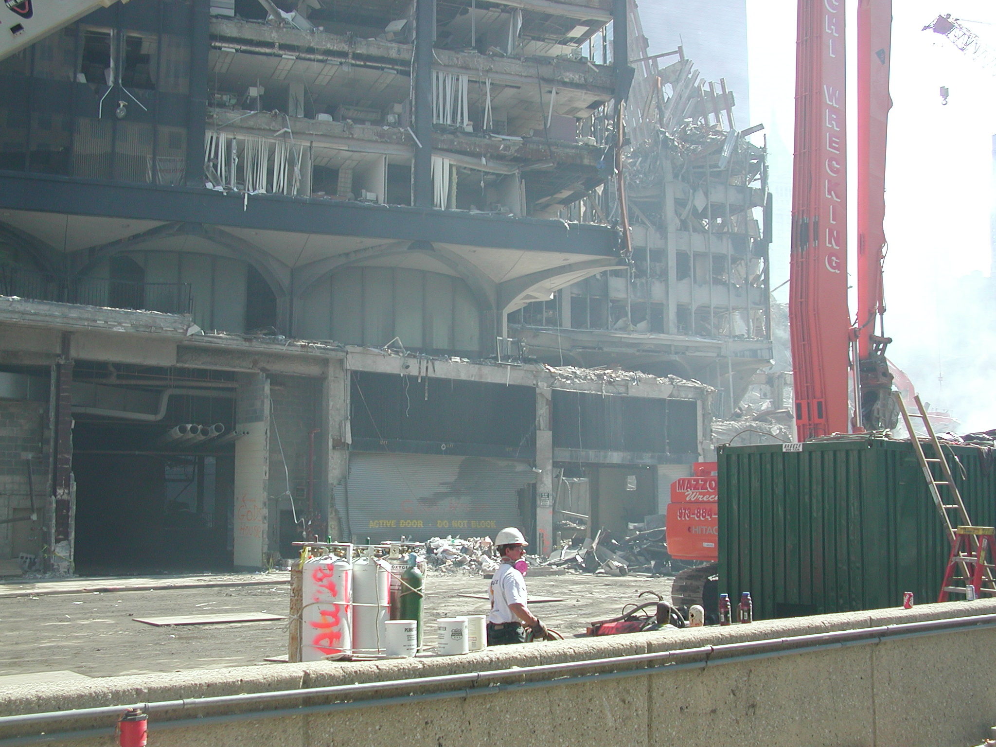
wtc066.jpg WTC, large box columns, part of
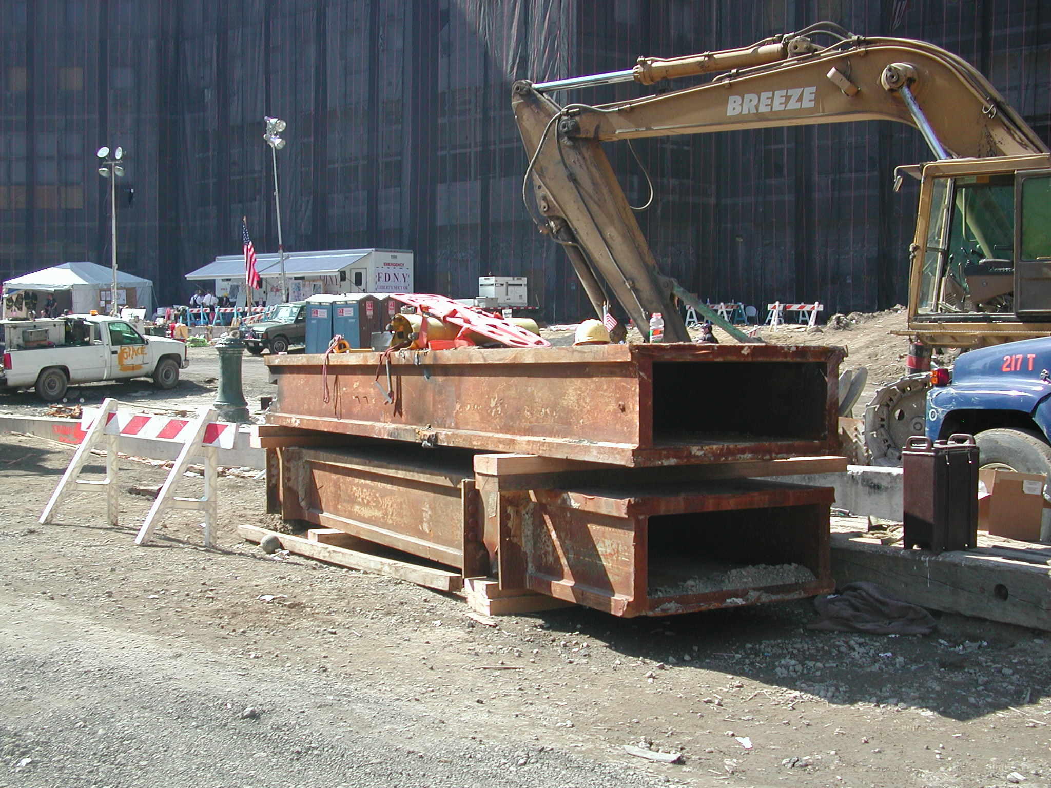
the tower core structure seen upright in 047.
wtc067.jpg WTC, remnants of North tower (map
1).
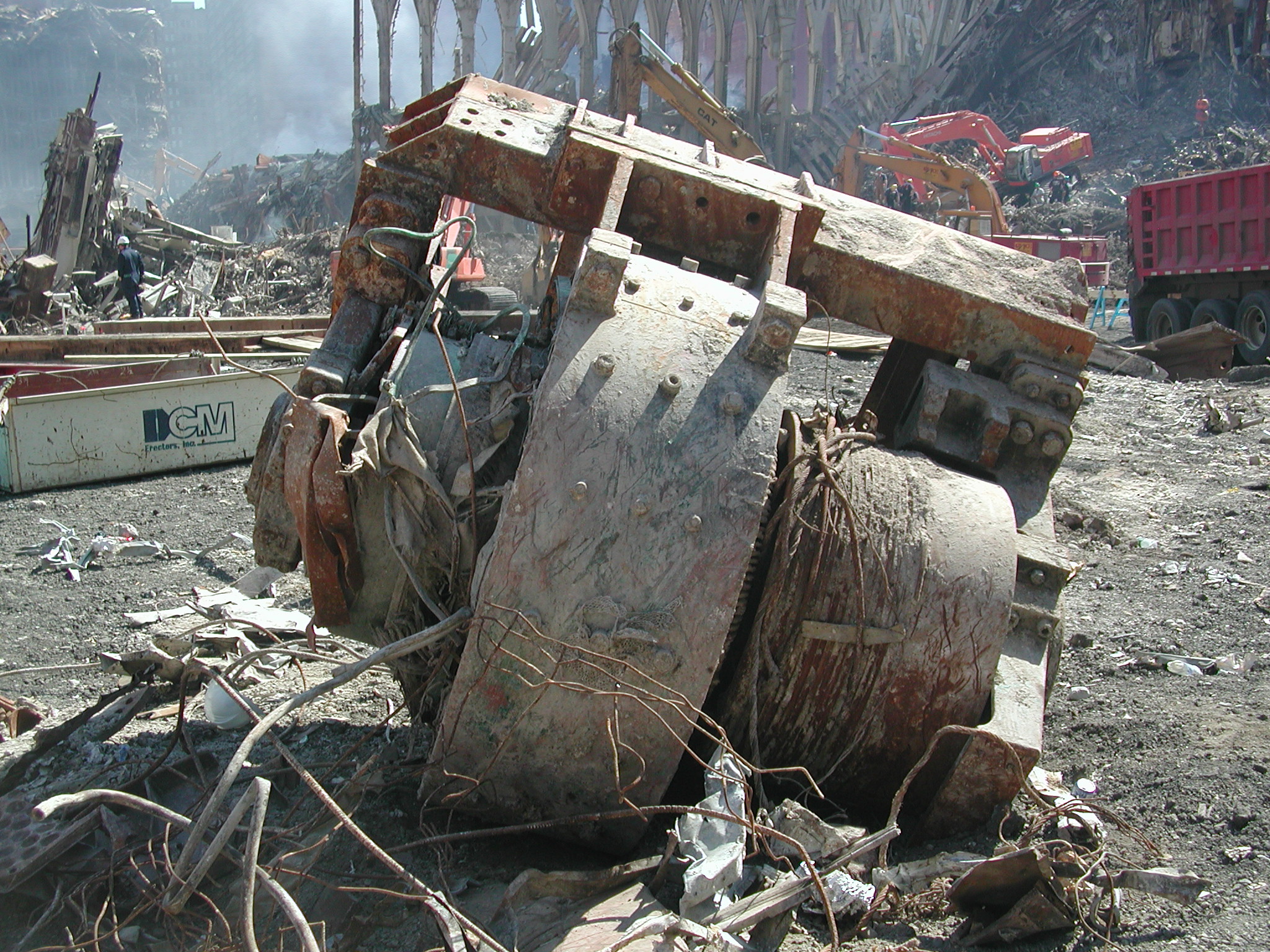
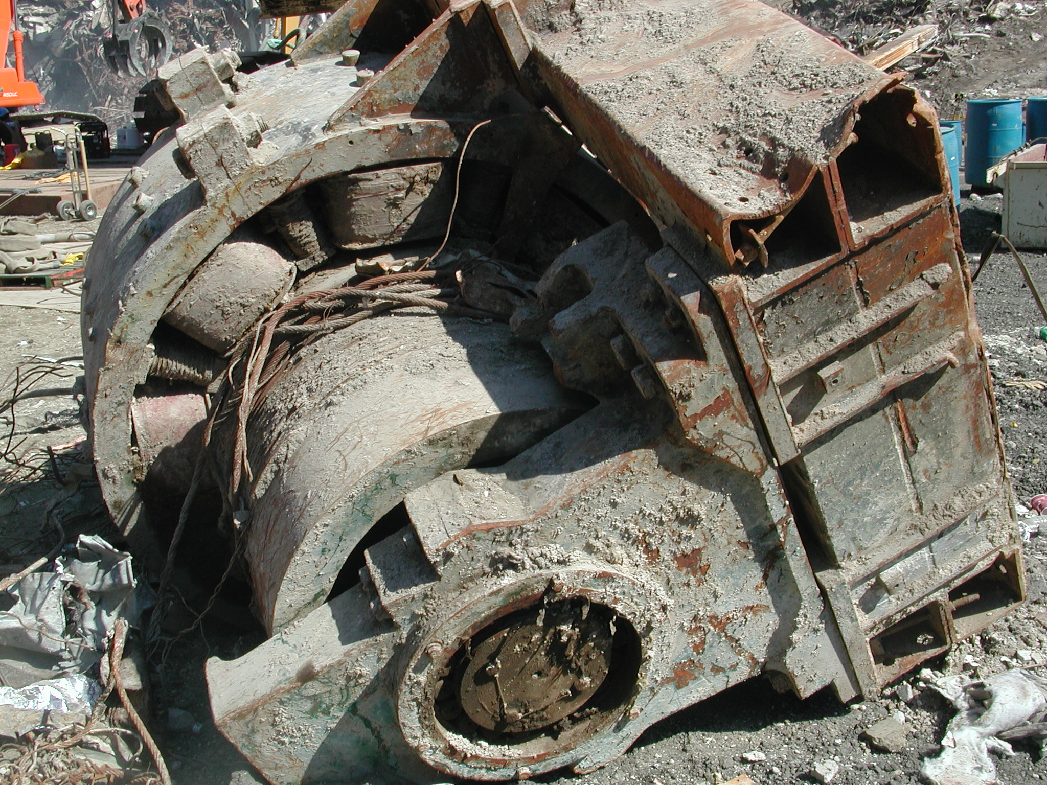
wtc068.jpg WTC, elevator machine motor.
wtc069.jpg WTC, elevator machine motor.
wtc070.jpg WTC, remnants of North Tower core
(map 1), 5 WTC in distance (map 5).
wtc071.jpg WTC, remnants of South Tower (map
2) and 4 WTC (map 4) in distance.
wtc072.jpg WTC, remnants of North Tower (map
1), 5 WTC in distance (map 5).
wtc073.jpg WTC, remnants of South Tower (map
2) and Marriott Hotel (map 3) at right.
A NYC police officer then halted photography. Path of police-escorted exit shown in green on the map.